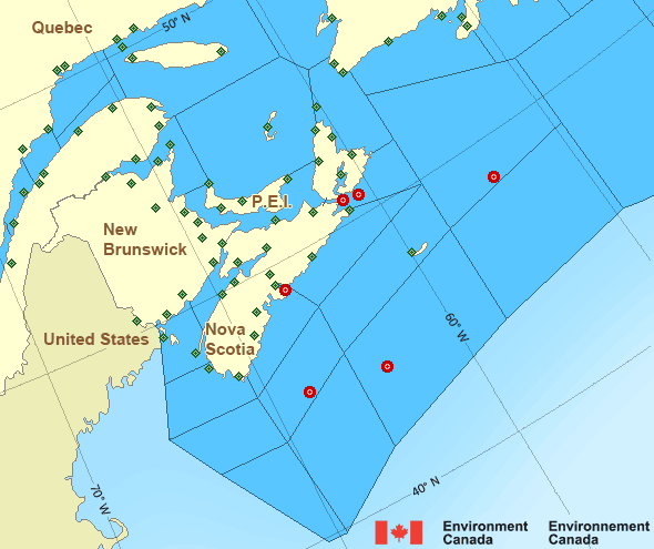
Browns Bank: Past 24 Hour Conditions
LaHave Bank - 44150
11:00 PM ADT 26 July 2024Buoy position: 42.5N 64.02W| Date / Time (ADT) |
Wind(knots) | Wave height(m) | Wave period(s) | Pressure(kPa) | Air temp(°C) | Water temp(°C) |
|---|---|---|---|---|---|---|
| 26 July 2024 | ||||||
| 23:00 | W 14 gusts 16 | 1.08 | 8.3 | 101.5 | 18 | 19 |
| 22:00 | W 13 gusts 16 | 1.24 | 8.3 | 101.5 | 18 | 19 |
| 21:00 | W 15 gusts 17 | 1.29 | 8.7 | 101.5 | 18 | 19 |
| 20:00 | W 14 gusts 17 | 1.32 | 8.0 | 101.4 | 18 | 20 |
| 19:00 | W 15 gusts 17 | 1.48 | 8.7 | 101.4 | 18 | 20 |
| 18:00 | W 13 gusts 15 | 1.37 | 6.9 | 101.4 | 18 | 19 |
| 17:00 | W 13 gusts 16 | 1.44 | 8.3 | 101.3 | 18 | 19 |
| 16:00 | W 13 gusts 16 | 1.60 | 8.7 | 101.3 | 18 | 19 |
| 15:00 | WNW 13 gusts 17 | 1.61 | 9.1 | 101.3 | 18 | 19 |
| 14:00 | W 13 gusts 16 | 1.54 | 8.7 | 101.3 | 18 | 19 |
| 13:00 | WNW 13 gusts 16 | 1.41 | 8.3 | 101.3 | 18 | 19 |
| 12:00 | WNW 13 gusts 16 | 1.45 | 9.1 | 101.3 | 17 | 19 |
| 11:00 | W 12 gusts 15 | 1.45 | 8.7 | 101.2 | 17 | 19 |
| 10:00 | W 15 gusts 18 | 1.40 | 8.7 | 101.2 | 17 | 19 |
| 9:00 | W 14 gusts 17 | 1.21 | 9.1 | 101.2 | 19 | 19 |
| 8:00 | W 14 gusts 17 | 1.28 | 8.7 | 101.2 | 19 | 19 |
| 7:00 | WSW 15 gusts 17 | 1.31 | 9.1 | 101.2 | 18 | 19 |
| 6:00 | WSW 15 gusts 17 | 1.44 | 8.7 | 101.1 | 19 | 19 |
| 5:00 | SW 12 gusts 14 | 1.46 | 8.3 | 101.1 | 20 | 19 |
| 4:00 | SW 10 gusts 11 | 1.53 | 8.0 | 101.1 | 19 | 19 |
| 3:00 | WSW 10 gusts 12 | 1.40 | 6.7 | 101.2 | 19 | 19 |
| 2:00 | WSW 11 gusts 14 | 1.60 | 8.7 | 101.3 | 19 | 19 |
| 1:00 | WSW 8 gusts 11 | 1.57 | 8.0 | 101.3 | 19 | 19 |
| 0:00 | WSW 7 gusts 9 | 1.33 | 8.7 | 101.4 | 19 | 19 |
| 25 July 2024 | ||||||
| 23:00 | SW 8 gusts 9 | 1.30 | 8.7 | 101.4 | 19 | 19 |
If you require additional historical weather information please visit Fisheries and Oceans Canada
Zoom-in to make a selection

Legend:
Atlantic - Maritimes Area
- Anticosti - eastern half
- Anticosti - western half
- Banquereau
- Bras d'Or Lakes
- Browns Bank
- Cabot Strait
- Chaleur - Miscou - eastern half
- Chaleur - Miscou - western half
- Eastern Shore
- East Coast - Cape St. Francis and south
- East Scotian Slope
- Fourchu
- Fundy
- Georges Bank
- Grand Manan
- Gulf - Magdalen
- Gulf - Port au Port
- Halifax Harbour and Approaches
- LaHave Bank
- Laurentian Fan
- Lurcher
- L'Isle-aux-Coudres to Tadoussac
- Northumberland Strait - eastern half
- Northumberland Strait - western half
- Pointe à Michel to Pointe-des-Monts
- Pointe-des-Monts to Anticosti - northern half
- Pointe-des-Monts to Anticosti - southern half
- Sable
- Southeastern Grand Banks
- Southwestern Grand Banks
- Southwestern Shore
- Southwest Coast
- South Coast
- Tadoussac to Pointe à Michel
- West Scotian Slope
Another Region
Features
New Predicting and Alerting Coastal Flooding Program

Find out about coastal flooding coverage, forecasts and warnings in your region
- Date modified: