Melville: Past 24 Hour Conditions
Ulukhaktok Airport
06:00 AM MDT 02 July 2025| Date / Time (MDT) |
Wind(knots) | Conditions | Visibility(km) | Pressure(kPa) | Air temp(°C) | Relative humidity(%) | Dew point(°C) |
|---|---|---|---|---|---|---|---|
| 02 July 2025 | |||||||
| 6:00 | NNW 8 | N/A | N/A | 101.0 | 9 | 78 | 5 |
| 5:00 | SSW 2 | N/A | N/A | 101.0 | 4 | 91 | 3 |
| 4:00 | S 3 | N/A | N/A | 100.9 | 3 | 94 | 2 |
| 3:00 | S 2 | N/A | N/A | 100.9 | 3 | 95 | 2 |
| 2:00 | SSE 2 | N/A | N/A | 100.9 | 3 | 94 | 2 |
| 1:00 | calm | N/A | N/A | 100.8 | 4 | 92 | 3 |
| 0:00 | S 4 | N/A | N/A | 100.8 | 3 | 93 | 2 |
| 01 July 2025 | |||||||
| 23:00 | SSE 4 | N/A | N/A | 100.7 | 4 | 91 | 3 |
| 22:00 | W 8 | N/A | N/A | 100.7 | 8 | 76 | 4 |
| 21:00 | WNW 9 | N/A | N/A | 100.6 | 8 | 79 | 5 |
| 20:00 | NW 11 | N/A | N/A | 100.6 | 13 | 72 | 8 |
| 19:00 | N 13 | N/A | N/A | 100.5 | 13 | 70 | 8 |
| 18:00 | SE 5 | N/A | N/A | 100.5 | 8 | 81 | 5 |
| 17:00 | WSW 10 | N/A | N/A | 100.5 | 4 | 89 | 2 |
| 16:00 | W 7 | N/A | N/A | 100.5 | 4 | 98 | 4 |
| 15:00 | W 12 | N/A | N/A | 100.4 | 3 | 97 | 3 |
| 14:00 | WNW 10 | N/A | N/A | 100.4 | 4 | 97 | 4 |
| 13:00 | W 8 | N/A | N/A | 100.4 | 3 | 96 | 2 |
| 12:00 | WSW 4 | N/A | N/A | 100.4 | 2 | 98 | 1 |
| 11:00 | W 10 | N/A | N/A | 100.4 | 1 | 97 | 1 |
| 10:00 | WSW 9 | N/A | N/A | 100.4 | 1 | 99 | 1 |
| 9:00 | W 8 | N/A | N/A | 100.4 | 1 | 98 | 1 |
| 8:00 | W 8 | N/A | N/A | 100.4 | 1 | 99 | 1 |
| 7:00 | WSW 7 | N/A | N/A | 100.5 | 1 | 99 | 1 |
| 6:00 | SSW 3 | N/A | N/A | 100.5 | 2 | 99 | 1 |
If you require additional historical weather information, please visit Climate Data Online
Zoom-in to make a selection

Legend:
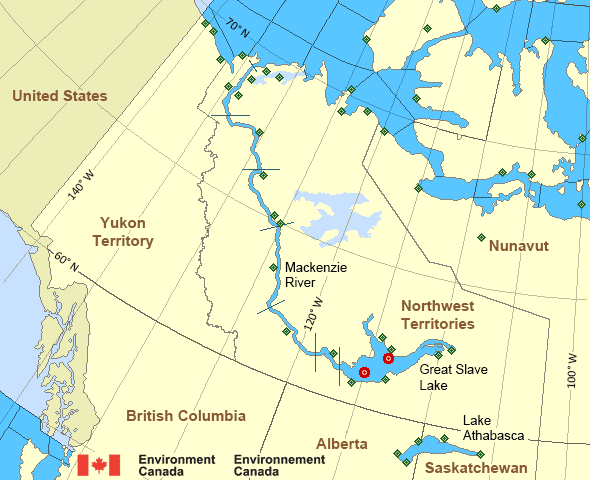
Mackenzie - Mackenzie River Area
- Amundsen
- Axe Point mile 91 to Camsell Bend mile 290
- Baillie
- Banks
- Bathurst
- Bowie - northern half
- Byam
- Camsell Bend mile 290 to Tulita mile 512
- Coronation
- Dease
- Dixon Entrance East
- Dixon Entrance West
- Dolphin
- Fort Good Hope mile 684 to Point Separation mile 913
- Great Slave Lake - basin
- Great Slave Lake - east arm
- Great Slave Lake - north arm
- Hecate Strait - northern half
- Lake Athabasca - eastern half
- Lake Athabasca - western half
- Larsen
- Mackenzie
- Maud
- McClintock
- McClure
- Melville
- North Mackenzie
- North Tuktoyaktuk
- Point Separation mile 913 to Kittigazuit Bay mile 1081
- Prince Alfred
- Prince of Wales
- Rae
- Tuktoyaktuk - northern half
- Tuktoyaktuk - southern half
- Tulita mile 512 to Fort Good Hope mile 684
- Ulukhaktok
- West Coast Haida Gwaii
- Wrigley Harbour mile 0 to Axe Point mile 91
- Yukon Coast
Another Region
- Date modified: