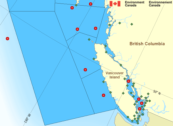
Hecate Strait - southern half: Past 24 Hour Conditions
South Hecate Strait - 46185
05:00 AM PDT 02 July 2025Buoy position: 52.85N 130.08W| Date / Time (PDT) |
Wind(knots) | Wave height(m) | Wave period(s) | Pressure(kPa) | Air temp(°C) | Water temp(°C) |
|---|---|---|---|---|---|---|
| 02 July 2025 | ||||||
| 5:00 | WNW 8 gusts 9 | 0.43 | 12.5 | 101.6 | 12 | 12 |
| 4:00 | NW 6 gusts 8 | 0.40 | 15.4 | 101.6 | 12 | 12 |
| 3:00 | NW 7 gusts 8 | 0.44 | 16.7 | 101.6 | 12 | 12 |
| 2:00 | NW 7 gusts 9 | 0.40 | 16.7 | 101.7 | 12 | 12 |
| 1:00 | NW 8 gusts 9 | 0.44 | 16.7 | 101.7 | 12 | 12 |
| 0:00 | WNW 6 gusts 7 | 0.36 | 13.3 | 101.7 | 12 | 12 |
| 01 July 2025 | ||||||
| 23:00 | WNW 5 gusts 5 | 0.39 | 13.3 | 101.7 | 12 | 12 |
| 22:00 | W 4 gusts 5 | 0.40 | 13.3 | 101.7 | 12 | 13 |
| 21:00 | W 5 gusts 6 | 0.36 | 13.3 | 101.7 | 12 | 13 |
| 20:00 | W 3 gusts 3 | 0.44 | 16.7 | 101.7 | 12 | 13 |
| 19:00 | N 3 gusts 3 | 0.39 | 5.7 | 101.7 | 13 | 13 |
| 18:00 | N 4 gusts 6 | 0.43 | 14.3 | 101.8 | 13 | 13 |
| 17:00 | WNW 9 gusts 11 | 0.45 | 14.3 | 101.8 | 12 | 13 |
| 16:00 | NW 7 gusts 8 | 0.43 | 14.3 | 101.9 | 13 | 13 |
| 15:00 | NNW 5 gusts 6 | 0.43 | 13.3 | 101.9 | 13 | 12 |
| 14:00 | NW 3 gusts 4 | 0.44 | 12.5 | 101.9 | 13 | 12 |
| 13:00 | WNW 4 gusts 5 | 0.40 | 13.3 | 101.9 | 13 | 12 |
| 12:00 | WNW 4 gusts 5 | 0.37 | 14.3 | 101.9 | 12 | 12 |
| 11:00 | W 5 gusts 6 | 0.41 | 13.3 | 101.8 | 12 | 12 |
| 10:00 | W 7 gusts 9 | 0.41 | 14.3 | 101.8 | 12 | 12 |
| 9:00 | W 8 gusts 10 | 0.44 | 14.3 | 101.8 | 12 | 12 |
| 8:00 | SW 5 gusts 6 | 0.49 | 14.3 | 101.8 | 12 | 12 |
| 7:00 | SW 8 gusts 9 | 0.48 | 14.3 | 101.8 | 12 | 12 |
| 6:00 | SSW 5 gusts 6 | 0.55 | 5.7 | 101.8 | 12 | 12 |
| 5:00 | SW 6 gusts 8 | 0.62 | 14.3 | 101.8 | 12 | 12 |
If you require additional historical weather information please visit Fisheries and Oceans Canada
Zoom-in to make a selection

Legend:
Pacific - South Coast Area
Another Region
- Date modified: