
Southwest Coast
Forecast
Marine Forecast
Issued 10:00 AM NDT 24 April 2026
Today Tonight and Saturday.
Wind northeast 10 to 15 knots backing to north 15 to 20 this afternoon then increasing to north 25 after midnight. Wind north 25 Saturday.
Flurries or showers overnight and Saturday.
Waves
Issued 06:00 AM NDT 24 April 2026
Today Tonight and Saturday.
Seas 1 metre or less building to 1 to 2 this evening except 2 to
3 over southeastern sections overnight and Saturday morning.
Extended Forecast
Issued 03:00 AM NDT 24 April 2026
Sunday
Wind north 20 knots.
Monday
Wind north 15 to 20 knots diminishing to
light.
Tuesday
Wind light.
Ice Forecast
Stay connected
 ATOM
ATOMWeather Conditions
Zoom-in to make a selection
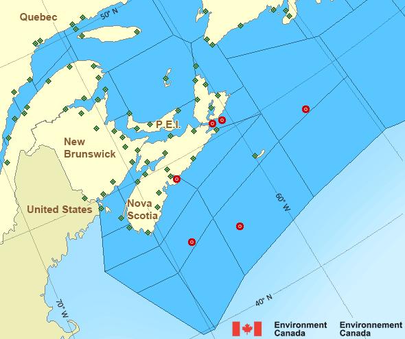
Legend:
 Buoy
Buoy  Land Station
 Ice Conditions
Ice Forecasts
Issued 10:00 AM EDT 23 April 2026 Today Tonight and FridayIce Edge
Ice edge estimated from Cape Breton Island near 4702N 6025W to 4746N6117W to 4730N 6400W to 4900N 6330W to 4845N 6145W to 5045N 5800W to
4830N 5930W to Newfoundland near 4806N 5905W. Sea ice southwest then
north of the ice edge.
Ice Coverage
Ice free.
Iceberg Bulletin
Issued 2:30 PM EDT 23 April 2026Iceberg Limit
Iceberg limit at 0000 UTC 24 Apr estimated from Newfoundland near4655N 5400W to 4320N 5020W to 4320N 4630W to 4630N 4410W to 5000N
4415W to 5305N 4755W to 5900N 5500W to 6015N 5245W to 5740N 4850W
then eastward.
Iceberg Count
No confirmed icebergs.Warnings
No watches or warnings in effect.
Synopsis
Technical Marine Synopsis
Issued 10:00 AM NDT 24 April 2026 Today Tonight and Saturday At 10:00 a.m. NDT today low 982 mb located over the southwesternGrand Banks.
By 10:00 a.m. NDT Saturday low 981 mb located over the northern
Grand Banks.
Marine Weather Statement
Issued 9:50 AM NDT 24 April 2026 A low pressure system over the Southwestern Grand Banks will slowlymove to lie over the Southeastern Grand Banks by this evening and
meander over the Northern Grand Banks on Saturday. Gale to storm
force easterlies to northeasterlies will spread over southeastern
waters north of the low today. Winds will shift to gale to storm
force southwesterlies to northwesterlies as the low passes.
On Saturday, winds northwest of the low will strengthen to strong to
gale force northerlies to northeasterlies.
Marine interests are advised that storm warnings are in effect for
the Southern Grand Banks. Gale warnings are in effect for Strait of
Belle Isle, East Coast - Cape St. Francis and south, Northeast Coast,
Belle Isle Bank, and Northern Grand Banks.
Atlantic - Maritimes Area
- Anticosti - eastern half
- Anticosti - western half
- Banquereau - eastern half
- Banquereau - western half
- Bras d'Or Lakes
- Browns Bank
- Cabot Strait
- Chaleur - Miscou - eastern half
- Chaleur - Miscou - western half
- Eastern Shore
- East Coast - Cape St. Francis and south
- East Scotian Slope
- Fourchu
- Fundy
- Georges Bank
- Grand Manan
- Gulf - Magdalen - eastern half
- Gulf - Magdalen - western half
- Gulf - Port au Port
- Halifax Harbour and Approaches
- LaHave Bank
- Laurentian Fan - northwestern half
- Laurentian Fan - southeastern half
- Lurcher
- L'Isle-aux-Coudres to Tadoussac
- Northumberland Strait - eastern half
- Northumberland Strait - western half
- Pointe à Michel to Pointe-des-Monts
- Pointe-des-Monts to Anticosti - northern half
- Pointe-des-Monts to Anticosti - southern half
- Sable
- Southeastern Grand Banks
- Southwestern Grand Banks
- Southwestern Shore
- Southwest Coast
- South Coast
- Tadoussac to Pointe à Michel
- West Scotian Slope
Another Region
Features
Colour-coded weather alerts

Learn more about weather alerting in Canada
- Date modified: