Atlantic - Maritimes
Forecast
The data for the page you have requested is not available. Please return to your previous selection or to the Marine Weather homepage.
Stay connected
Weather Conditions
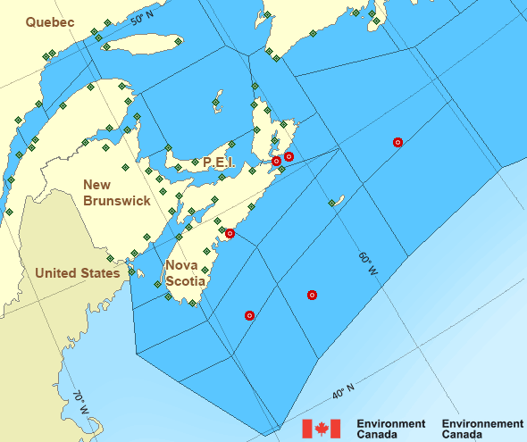
Zoom-in to make a selection

Legend:
Ice Conditions
The data for the page you have requested is not available. Please return to your previous selection or to the Marine Weather homepage.
Warnings
No watches or warnings in effect.
Synopsis
The data for the page you have requested is not available. Please return to your previous selection or to the Marine Weather homepage.
Atlantic - Maritimes Area
- Anticosti - eastern half
- Anticosti - western half
- Banquereau - northwestern half
- Banquereau - southeastern half
- Bras d'Or Lakes
- Browns Bank
- Cabot Strait - northern half
- Cabot Strait - southern half
- Chaleur - Miscou - eastern half
- Chaleur - Miscou - western half
- Eastern Shore - eastern half
- Eastern Shore - western half
- East Coast - Cape St. Francis and south
- East Scotian Slope - eastern half
- East Scotian Slope - western half
- Fourchu
- Fundy
- Georges Bank
- Grand Manan
- Gulf - Magdalen - eastern half
- Gulf - Magdalen - western half
- Gulf - Port au Port - northwestern half
- Gulf - Port au Port - southeastern half
- Halifax Harbour and Approaches
- LaHave Bank
- Laurentian Fan
- Lurcher
- L'Isle-aux-Coudres to Tadoussac
- Northumberland Strait - eastern half
- Northumberland Strait - western half
- Pointe à Michel to Pointe-des-Monts
- Pointe-des-Monts to Anticosti - northern half
- Pointe-des-Monts to Anticosti - southern half
- Sable - eastern half
- Sable - western half
- Southeastern Grand Banks
- Southwestern Grand Banks
- Southwestern Shore
- Southwest Coast
- South Coast
- Tadoussac to Pointe à Michel
- West Scotian Slope
Another Region
- Date modified:
 ATOM
ATOM