
South Coast
Forecast
Marine Forecast
Issued 03:00 AM NDT 04 June 2024
Today Tonight and Wednesday.
Wind northeast 20 knots veering to southeast 15 overnight. Wind southeast 15 Wednesday.
Showers and fog.
Waves
Issued 06:00 PM NDT 03 June 2024
Tonight and Tuesday.
Seas 1 to 2 metres.
Extended Forecast
Issued 03:00 AM NDT 04 June 2024
Thursday
Wind east 10 to 15 knots diminishing to light
in the afternoon.
Friday
Wind light.
Saturday
Wind northeast 15 to 20 knots.
Ice Forecast
Stay connected
 ATOM
ATOMWeather Conditions
Zoom-in to make a selection
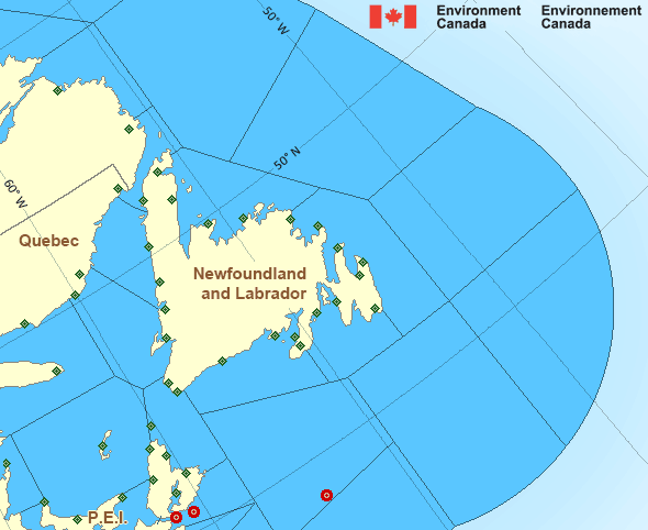
Legend:
 Buoy
Buoy  Land Station
 Ice Conditions
Ice Forecasts
Issued 10:00 AM EDT 3 June 2024 Today Tonight and TuesdayIce Edge
Ice edge estimated from Labrador near 5439N 5727W to 5523N 5406W to5812N 5827W to 5926N 5828W to 6107N 6118W to 6200N 6001W then
northeastward. Sea ice north then west of the ice edge.
Ice Coverage
Ice free.
Iceberg Bulletin
Issued 2:30 PM EDT 3 June 2024Iceberg Limit
Iceberg limit at 0000 UTC 4 Jun estimated from Newfoundland near4657N 5300W to 4815N 5125W to 5325N 4945W to 5725N 5105W to 5625N
4825W then eastwards.
Western iceberg limit at 0000 UTC 4 Jun estimated from Quebec near
5013N 6108W to Newfoundland near 4906N 5824W.
Iceberg Count
No confirmed icebergs.Warnings
No watches or warnings in effect.
Synopsis
Technical Marine Synopsis
Issued 3:00 AM NDT 4 June 2024 Today Tonight and Wednesday At 3:00 a.m. NDT today quasi-stationary low 1004 mb located southof Newfoundland.
Atlantic - Newfoundland Area
- Anticosti - eastern half
- Anticosti - western half
- Banquereau
- Belle Isle Bank
- Bras d'Or Lakes
- Cabot Strait - northern half
- Cabot Strait - southern half
- Chaleur - Miscou - eastern half
- Chaleur - Miscou - western half
- Eastern Shore - eastern half
- East Coast - Cape St. Francis and south
- East Coast - north of Cape St. Francis
- Fourchu
- Funk Island Bank
- Gulf - Magdalen - eastern half
- Gulf - Magdalen - western half
- Gulf - Port au Port
- Lake Melville
- Laurentian Fan
- Mid Labrador Coast
- Northeast Coast
- Northeast Gulf
- Northern Grand Banks
- Northumberland Strait
- Sable - eastern half
- Southeastern Grand Banks
- Southwestern Grand Banks
- Southwest Coast
- South Coast
- South Labrador Coast
- South Labrador Sea
- Strait of Belle Isle - eastern half
- Strait of Belle Isle - western half
Another Region
Features
New Predicting and Alerting Coastal Flooding Program

Find out about coastal flooding coverage, forecasts and warnings in your region
- Date modified: