Language selection

Weather shortcuts

Laurentian Fan

Forecast

Marine Forecast

Issued 10:00 AM ADT 06 September 2026

Today Tonight and Monday.

Wind southwest 20 to 25 knots except southwest 15 over northern sections. Wind becoming west 25 late overnight. Wind west 25 Monday.

Scattered showers.

Waves

Issued 05:00 AM ADT 06 September 2026
Today Tonight and Monday. Seas 2 to 3 metres building to 3 to 5 Monday morning.

Extended Forecast

Issued 03:00 AM ADT 06 September 2026
Tuesday Wind northwest 25 knots diminishing to west 15 in the afternoon.
Wednesday Wind variable 10 to 15 knots increasing to north 30.
Thursday Wind light increasing to southwest 25 knots.

Stay connected

ATOM

Weather Conditions

Skip Image

Zoom-in to make a selection

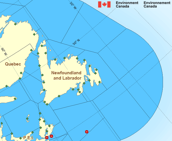
Map of Atlantic - Newfoundland marine weather areas Englee Winterland Branch Hill Twillingate Stephenville Eskasoni (First Nations) St. Lawrence Grand Étang St. John's Int'l Airport St. Anthony Airport Ingonish Beach Sagona Island Port aux Basques La Scie Ferolle Point North Mountain West Chedabucto Bay – 44489 Daniel's Harbour Corner Brook St.Paul Island Cape Race J.A. Douglas McCurdy Sydney Airport Burgeo Bonavista Berry Hill Argentia Charlottetown Airport East Point North Cape Wreckhouse East Chedabucto Bay – 44488 Blanc-Sablon Airport Cap Whittle Chevery Banquereau - 44139 Mary's Harbour Cartwright Airport Natashquan Airport Miscou Island Long Pond Îles de la Madeleine Airport Marticot Island Pool's Island Grates Cove
Legend:
buoy Buoy
land station Land Station
Ice Conditions

Ice Forecasts

Issued 10:00 AM EDT 19 May 2026 Forecasts have ended for the season.
 

Iceberg Bulletin

Issued 2:30 PM EDT 5 September 2026

Iceberg Limit

Iceberg limit at 0000 UTC 6 Sep estimated from Newfoundland near
4910N 5455W to 5400N 5300W to 6000N 5600W to 6130N 5420W to 5900N
4610W then eastward.

Iceberg Count

No confirmed icebergs.
Warnings

No watches or warnings in effect.

Synopsis

Technical Marine Synopsis

Issued 10:00 AM ADT 6 September 2026 Today Tonight and Monday At 10:00 a.m. ADT today low 997 mb located over southern Banquereau.
By 3:00 a.m. ADT Monday low 997 mb located over northern Banquereau.

At 3:30 p.m. ADT Monday departing low 999 mb located over
Newfoundland.

Marine Weather Statement

Issued 9:49 AM ADT 6 September 2026 A low pressure system over Banquereau will remain nearly stationary
today and tonight. On Monday the low will move slowly northward to
lie over Newfoundland Monday afternoon. Strong to gale force
northeasterlies over northern and eastern waters will gradually
diminish later today and Monday.

Marine interests are advised that gale warnings are in effect for
Banquereau - northern half, Cabot Strait, Gulf-Magdalen and Anticosti
- southeastern half.

Atlantic - Newfoundland Area

Another Region

Features

Colour-coded weather alerts

Learn more about weather alerting in Canada

Improved storm alerts

Learn more about targeted warnings for severe thunderstorms and tornadoes

Date modified: