
Gulf - Port au Port
Forecast
Marine Forecast
Issued 03:00 AM NDT 26 April 2024
Today Tonight and Saturday.
Wind west 15 knots becoming variable 10 to 15 overnight. Wind variable 10 to 15 Saturday.
Flurries ending this afternoon.
Temperatures near zero.
Waves
Issued 06:00 AM NDT 26 April 2024
Today Tonight and Saturday.
Seas 2 to 3 metres subsiding to 1 to 2 this morning and to 1 or
less this evening.
Extended Forecast
Issued 03:00 AM NDT 26 April 2024
Sunday
Wind variable 10 to 15 knots.
Monday
Wind variable 10 to 15 knots increasing to
northeast 25 to 35.
Tuesday
Wind north 35 knots.
Ice Forecast
Issued 10:00 AM EDT 25 April 2024 Today Tonight and Friday Bergy water except 1 tenth rotten first-year ice along parts of the
Quebec coast.
Stay connected
 ATOM
ATOMWeather Conditions
Zoom-in to make a selection
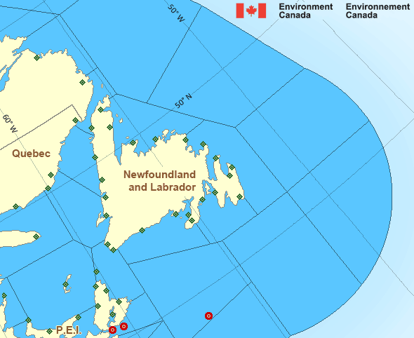
Legend:
 Buoy
Buoy  Land Station
 Ice Conditions
Ice Forecasts
Issued 10:00 AM EDT 25 April 2024 Today Tonight and FridayIce Edge
Ice edge estimated from Quebec near 5014N 6215W to 5005N 6212W to4950N 6034W to 5114N 5741W to 5117N 5728W then northeastward. Sea
ice north of the ice edge.
Ice Coverage
Bergy water except 1 tenth rotten first-year ice along parts of the
Quebec coast.
Iceberg Bulletin
Issued 3:05 PM EDT 25 April 2024Iceberg Limit
Iceberg limit at 0000 UTC 26 Apr estimated from Newfoundland near4729N 5245W to 4805N 4945W to 5115N 4635W to 5615N 5010W to 5740N
5210W then eastwards.
Western iceberg limit at 0000 UTC 26 Apr estimated from Quebec near
5013N 6130W to Newfoundland near 4905N 5804W.
Iceberg Count
No confirmed icebergs except less than 10 icebergs northeast of thewestern iceberg limit.
Warnings
No watches or warnings in effect.
Synopsis
Technical Marine Synopsis
Issued 3:00 AM NDT 26 April 2024 Today Tonight and Saturday At 3:00 a.m. NDT today low 993 mb located over central Labrador Sea.By 3:00 a.m. NDT Saturday low 1000 mb located over eastern
Labrador Sea.
At 8:00 p.m. NDT tonight approaching trough located south of the
Marine District.
At 3:00 a.m. NDT today ridge located over the Maritimes.
By 3:00 a.m. NDT Saturday ridge located on a line
northeast-southwest over Newfoundland.
Marine Weather Statement
Issued 2:42 AM NDT 26 April 2024 A trough of low pressure system will approach the marine districtfrom the south this evening. Strong to gale force northeasterlies
will spread across the Southern Grand Banks on Saturday ahead of the
trough.
Marine interests are advised that gale warnings are in effect for the
Southern Grand Banks.
Atlantic - Newfoundland Area
- Anticosti - eastern half
- Anticosti - western half
- Banquereau
- Belle Isle Bank
- Bras d'Or Lakes
- Cabot Strait - northern half
- Cabot Strait - southern half
- Chaleur - Miscou
- Eastern Shore - eastern half
- East Coast - Cape St. Francis and south
- East Coast - north of Cape St. Francis
- Fourchu
- Funk Island Bank
- Gulf - Magdalen - northeastern half
- Gulf - Magdalen - southwestern half
- Gulf - Port au Port
- Lake Melville
- Laurentian Fan
- Mid Labrador Coast
- Northeast Coast
- Northeast Gulf
- Northern Grand Banks
- Northumberland Strait
- Sable - eastern half
- Southeastern Grand Banks
- Southwestern Grand Banks
- Southwest Coast
- South Coast
- South Labrador Coast
- South Labrador Sea - northwestern half
- South Labrador Sea - southeastern half
- Strait of Belle Isle
Another Region
Features
Fourth Intergovernmental Negotiating Committee (INC-4) - Canada.ca

Canada is hosting United Nations negotiations in Ottawa April 23-29 to develop a global agreement on plastic pollution by the end of 2024.
- Date modified: