Cabot Strait
Forecast
Marine Forecast
Issued 08:00 PM ADT 09 September 2026
Tonight and Thursday.
Gale warning in effect.
Wind southerly 15 knots increasing to south 25 late overnight and to south 35 near noon Thursday. Wind diminishing to southwest 25 Thursday evening.
Showers Thursday.
Waves
Issued 05:00 PM ADT 09 September 2026
Tonight and Thursday.
Seas 1 metre or less building to 1 to 2 early Thursday morning
and to 2 to 3 near noon Thursday. Seas building to 3 to 4 Thursday afternoon
then subsiding to 2 to 3 Thursday evening.
Extended Forecast
Issued 03:30 PM ADT 09 September 2026
Friday
Wind west 20 knots increasing to northwest 30
in the afternoon.
Saturday
Wind northwest 20 knots diminishing to light
late in the day.
Sunday
Wind light increasing to southwest 20
knots.
Stay connected
Weather Conditions
Zoom-in to make a selection
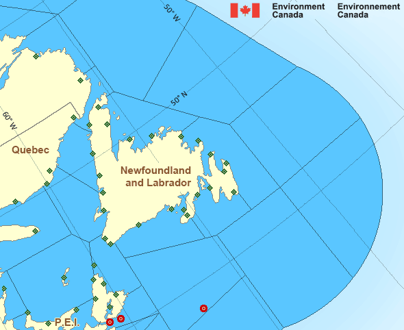
Legend:
Ice Conditions
Ice Forecasts
Issued 10:00 AM EDT 19 May 2026 Forecasts have ended for the season.Iceberg Bulletin
Issued 2:30 PM EDT 9 September 2026Iceberg Limit
Iceberg limit at 0000 UTC 10 Sep estimated from Newfoundland near4930N 5510W to 5500N 5215W to 6000N 5730W to 6130N 5420W to 5900N
4610W then northeastward.
Iceberg Count
No confirmed icebergs.Warnings
Warnings (In effect)
Gale warning in effect
Cabot Strait
Issued 8:00 PM ADT 09 September 2026'Gale' force winds of 34 to 47 knots are occurring or expected to occur in this marine area. Watch for updated statements. Please refer to the latest marine forecasts for further details and continue to monitor the situation through Canadian Coast Guard radio.
Synopsis
Technical Marine Synopsis
Issued 8:00 PM ADT 9 September 2026 Tonight and Thursday At 8:00 p.m. ADT tonight ridge located from Newfoundland to WestScotian Slope.
By 10:00 a.m. ADT Thursday departing ridge located from the Grand
Banks to Laurentian Fan.
At 8:00 p.m. ADT tonight trough located over Quebec.
By 3:30 p.m. ADT Thursday trough located from Labrador to
Southwestern Shore.
At 8:00 p.m. ADT tonight departing trough located over the southern
Grand Banks.
Marine Weather Statement
Issued 7:56 PM ADT 9 September 2026 A trough of low pressure will approach the marine district tonightand cross the region on Thursday. Strong to gale force
southwesterlies will develop ahead of this system.
Marine interests are advised that gale warnings are in effect for all
waters except Georges Bank, West Scotian Slope, East Scotian Slope,
and Chaleur-Miscou - western half.
Atlantic - Newfoundland Area
- Anticosti
- Banquereau
- Belle Isle Bank
- Bras d'Or Lakes
- Cabot Strait
- Chaleur - Miscou - eastern half
- Chaleur - Miscou - western half
- Eastern Shore - eastern half
- East Coast - Cape St. Francis and south
- East Coast - north of Cape St. Francis
- Fourchu
- Funk Island Bank
- Gulf - Magdalen - northwestern half
- Gulf - Magdalen - southeastern half
- Gulf - Port au Port
- Lake Melville
- Laurentian Fan
- Mid Labrador Coast
- Northeast Coast
- Northeast Gulf
- Northern Grand Banks
- Northumberland Strait - eastern half
- Northumberland Strait - western half
- Sable - eastern half
- Southeastern Grand Banks
- Southwestern Grand Banks
- Southwest Coast
- South Coast
- South Labrador Coast
- South Labrador Sea
- Strait of Belle Isle - eastern half
- Strait of Belle Isle - western half
Another Region
Features
Colour-coded weather alerts
Learn more about weather alerting in Canada
Improved storm alerts
Learn more about targeted warnings for severe thunderstorms and tornadoes
- Date modified:
ATOM