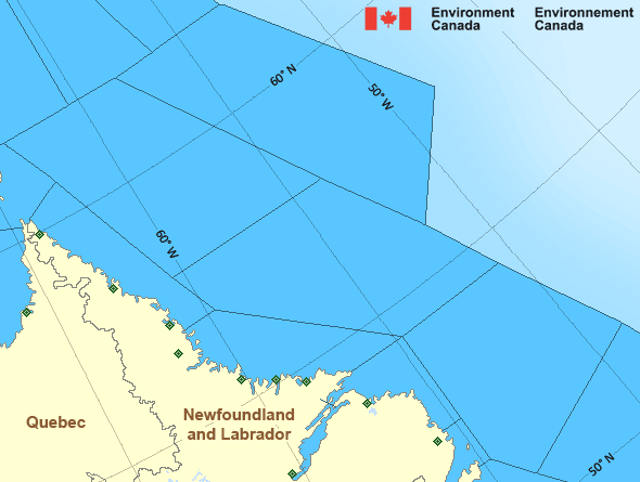
Strait of Belle Isle
Forecast
Marine Forecast
Issued 03:30 PM NDT 12 May 2024
Tonight and Monday.
Wind east 20 knots increasing to northeast 30 early this evening then diminishing to variable 10 to 15 late overnight. Wind variable 10 to 15 Monday.
Snow or rain becoming rain this evening and ending Monday morning. Fog patches forming this evening and dissipating overnight.
Waves
Issued 06:00 AM NDT 12 May 2024
Strait of Belle Isle - eastern half
Today Tonight and Monday.
Seas 1 to 2 metres building to 2 to 3 this evening then subsiding
to 1 to 2 Monday evening.
Strait of Belle Isle - western half
Today Tonight and Monday.
Seas 1 metre or less building to 1 to 2 this afternoon then
subsiding to 1 or less late overnight.
Extended Forecast
Issued 03:30 PM NDT 12 May 2024
Tuesday
Wind variable 10 to 15 knots.
Wednesday
Wind variable 10 to 15 knots increasing to
northeast 15 to 20.
Thursday
Wind variable 15 knots.
Ice Forecast
Stay connected
Weather Conditions
Zoom-in to make a selection

Legend:
Ice Conditions
Ice Forecasts
Issued 10:00 AM EDT 12 May 2024 Today Tonight and MondayIce Edge
Ice edge estimated from Labrador near 5213N 5537W to 5320N 5441W to5512N 5500W to 5652N 5757W to 6020N 5935W to 6200N 5918W then
northeastward. Sea ice north then west of the ice edge.
Ice Coverage
Bergy water.
Iceberg Bulletin
Issued 2:30 PM EDT 12 May 2024Iceberg Limit
Iceberg limit at 0000 UTC 13 May estimated from Newfoundland near4708N 5255W to 4745N 5000W to 4830N 4800W to 5415N 4740W to 5740N
5210W to 5805N 4955W then eastwards.
Western iceberg limit at 0000 UTC 13 May estimated from Quebec near
5012N 6107W to Newfoundland near 4838N 5834W.
Iceberg Count
More than 100 icebergs.Warnings
No watches or warnings in effect.
Synopsis
Technical Marine Synopsis
Issued 3:30 PM NDT 12 May 2024 Tonight and Monday At 3:30 p.m. NDT today ridge located east of the Marine District.By 8:00 p.m. NDT tonight departing ridge located on a line east-west
over southern Labrador Sea.
At 3:30 p.m. NDT today low 997 mb located over the Southwest Coast
of Newfoundland.
By 3:30 p.m. NDT Monday low 1010 mb located north of Belle Isle
Bank.
Marine Weather Statement
Issued 3:13 PM NDT 12 May 2024 A low pressure system will track northwards over Newfoundland tonightbefore departing the marine district tomorrow. Gale force northeast
to southeasterly winds are expected over south and western waters
today ahead of this system.
Marine interests are advised that gale warnings are in effect for the
Gulf waters, Southwest Coast, South Coast and East Coast.
Atlantic - Labrador Area
Another Region
- Date modified:
 ATOM
ATOM