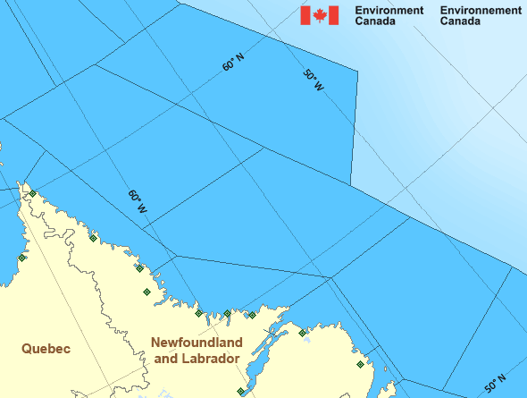
South Labrador Sea
Forecast
Marine Forecast
Issued 09:30 AM NDT 01 May 2025
Today Tonight and Friday.
Wind north 30 knots except north 10 to 15 over northwestern sections. Wind diminishing to northwest 25 Friday morning.
Rain or snow ending Friday afternoon. Visibility 1 mile or less in precipitation.
Temperatures near zero.
Waves
Issued 06:00 AM NDT 01 May 2025
Today Tonight and Friday.
Outside the ice edge seas 3 to 4 metres except 1 to 2 over
northwestern sections today tonight and Friday morning and 2 to 3 over
northwestern sections Friday afternoon and evening.
Extended Forecast
Issued 04:00 AM NDT 01 May 2025
Saturday
Wind northwest 15 to 20 knots diminishing to
variable 10 to 15 in the afternoon.
Sunday
Wind west 15 knots.
Monday
Wind northwest 25 to 35 knots.
Ice Forecast
Issued 10:00 AM EDT 1 May 2025 Today Tonight and Friday Bergy water except 3 tenths first-year ice including a trace of old
ice in the extreme western section.
Stay connected
Weather Conditions
Zoom-in to make a selection

Legend:
Ice Conditions
Ice Forecasts
Issued 10:00 AM EDT 1 May 2025 Today Tonight and FridayIce Edge
Ice edge estimated from Newfoundland near 4904N 5336W to 4853N 5147Wto 5440N 5230W to 5628N 5621W to 6108N 5855W to 6200N 5830W then
northeastward. Sea ice north then west of the ice edge.
Ice Coverage
Bergy water except 3 tenths first-year ice including a trace of old
ice in the extreme western section.
Iceberg Bulletin
Issued 3:25 PM EDT 30 April 2025Iceberg Limit
Iceberg limit at 0000 UTC 1 May estimated from Newfoundland near4723N 5503W to 4040N 5210W to 4100N 4720W to 4530N 3335W to 4710N
3245W to 5915N 5605W to 6035N 5500W to 5920N 4925W then eastwards.
Western iceberg limit at 0000 UTC 1 May estimated from Quebec near
5020N 6115W to Newfoundland near 4805N 5845W.
Iceberg Count
Unknown number of icebergs.Warnings
No watches or warnings in effect.
Synopsis
Technical Marine Synopsis
Issued 9:30 AM NDT 1 May 2025 Today Tonight and Friday At 9:30 a.m. NDT today low 994 mb located over Newfoundland.By 9:30 a.m. NDT Friday low 996 mb located northeast of Belle
Isle Bank.
At 9:30 a.m. NDT today ridge located on a line northeast-southwest
over the North Labrador Coast.
By 4:00 a.m. NDT Friday dissipating ridge located on a line
northeast-southwest over the Northwest Labrador Sea.
Marine Weather Statement
Issued 9:22 AM NDT 1 May 2025 A low pressure system over Newfoundland will track northeastwardtoday to lie northeast of Belle Isle Bank by Friday morning where it
will stall on Friday. Strong to gale force northerlies can be
expected over southern waters behind the low.
Marine interests are advised that a gale warning is in effect for
South Labrador Coast.
Marine interests are also advised that a freezing spray warning is in
effect for Northwest Labrador Sea.
Atlantic - Labrador Area
Another Region
- Date modified:
 ATOM
ATOM