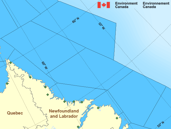
South Labrador Coast
Forecast
Marine Forecast
Issued 09:30 PM NDT 14 May 2025
Tonight and Thursday.
Gale warning in effect.
Wind south 15 to 20 knots increasing to northwest 35 late overnight then diminishing to northwest 25 Thursday afternoon.
Showers and fog patches ending Thursday morning with a risk of thunderstorms.
Temperatures near zero.
Waves
Extended Forecast
Ice Forecast
Stay connected
Weather Conditions
Zoom-in to make a selection

Ice Conditions
Ice Forecasts
Issued 3:13 PM EDT 14 May 2025 Today Tonight and ThursdayIce Edge
First ice edge estimated from Labrador near 5158N 5554W to Newfoundland near 5138N 5554W. Sea ice east of the ice edge.Second ice edge estimated from Newfoundland near 5008N 5636W to 5022N 5428W to 5430N 5421W to 5733N 5817W to 6123N 5829W to 6200N 5622W then northeastward. Sea ice north then west of the ice edge.
Ice Coverage
1 tenth first-year ice including a trace of old ice except 9 tenths first-year ice including a trace of old ice along parts of the coast south of Cartwright. Consolidated rotten first-year ice along parts of the coast.
Iceberg Bulletin
Issued 2:30 PM EDT 14 May 2025Iceberg Limit
Iceberg limit at 0000 UTC 15 May estimated from Newfoundland near 4723N 5503W to 4128N 5121W to 4120N 4720W to 4835N 4125W to 5320N 4815W to 5915N 5605W to 5825N 5020W then eastward.Iceberg Count
More than 100 icebergs.Warnings
Warnings (In effect)
Gale warning in effect
South Labrador Coast
Issued 10:46 PM NDT 14 May 2025'Gale' force winds of 34 to 47 knots are occurring or expected to occur in this marine area. Watch for updated statements. Please refer to the latest marine forecasts for further details and continue to monitor the situation through Canadian Coast Guard radio or Weatheradio stations.
Synopsis
Technical Marine Synopsis
Issued 9:30 PM NDT 14 May 2025 Tonight and Thursday At 9:30 p.m. NDT tonight trough located on a line north-south overthe Mid Labrador Coast.
By 4:00 p.m. NDT Thursday trough located on a line
northwest-southeast over Labrador Sea.
At 9:30 p.m. NDT tonight dissipating low 997 mb located southeast
of the Marine District.
Marine Weather Statement
Issued 9:12 PM NDT 14 May 2025 A trough of low pressure approaching from the west is forecast totrack across the Labrador coast tonight before stalling over the
Labrador Sea on Thursday. Strong to gale force southerlies ahead of
this system will shift to strong to gale force northwesterlies in its
wake.
Marine interests are advised that gale warnings are in effect for all
waters except Lake Melville and East Labrador Sea.
Atlantic - Labrador Area
Another Region
- Date modified:
 ATOM
ATOM