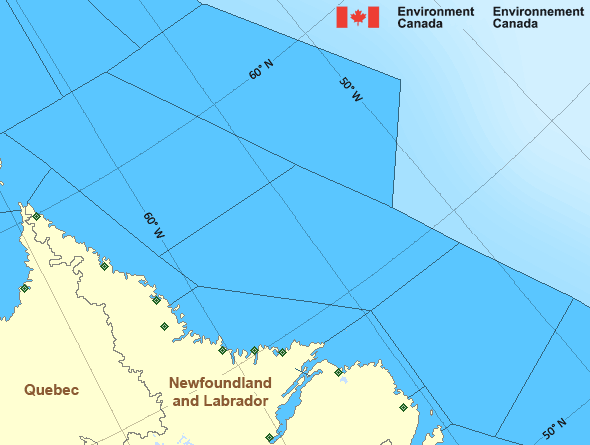
Northeast Coast
Forecast
Marine Forecast
Issued 03:00 AM NDT 01 May 2025
Today Tonight and Friday.
Gale warning in effect.
Wind variable 10 to 15 knots increasing to northwest 25 this morning except northwest 35 over eastern sections Friday morning. Wind diminishing to northwest 15 to 20 Friday afternoon and to light Friday evening.
Periods of rain changing to showers or flurries early this morning and ending Friday morning. Fog patches dissipating near noon.
Waves
Extended Forecast
Ice Forecast
Stay connected
Weather Conditions
Zoom-in to make a selection

Ice Conditions
Ice Forecasts
Issued 10:00 AM EDT 30 April 2025 Today Tonight and ThursdayIce Edge
Ice edge estimated from Newfoundland near 4837N 5300W to 4845N 5129Wto 5442N 5216W to 5601N 5609W to 6108N 5855W to 6200N 5830W then
northeastward. Sea ice north then west of the ice edge.
Ice Coverage
1 tenth first-year ice including a trace of old ice except 5 tenths
first-year ice including a trace of old ice in the extreme
northeastern section. Consolidated rotten first-year ice along parts
of the coasts.
Iceberg Bulletin
Issued 3:25 PM EDT 30 April 2025Iceberg Limit
Iceberg limit at 0000 UTC 1 May estimated from Newfoundland near4723N 5503W to 4040N 5210W to 4100N 4720W to 4530N 3335W to 4710N
3245W to 5915N 5605W to 6035N 5500W to 5920N 4925W then eastwards.
Western iceberg limit at 0000 UTC 1 May estimated from Quebec near
5020N 6115W to Newfoundland near 4805N 5845W.
Iceberg Count
26 to 50 icebergs.Warnings
Warnings (In effect)
Gale warning in effect
Northeast Coast
Issued 03:00 AM NDT 01 May 2025'Gale' force winds of 34 to 47 knots are occurring or expected to occur in this marine area. Watch for updated statements. Please refer to the latest marine forecasts for further details and continue to monitor the situation through Canadian Coast Guard radio or Weatheradio stations.
Synopsis
Technical Marine Synopsis
Issued 3:00 AM NDT 1 May 2025 Today Tonight and Friday At 3:00 a.m. NDT today low 993 mb located over Newfoundland.By 3:00 a.m. NDT Friday low 994 mb located northeast of Belle
Isle Bank.
At 3:00 a.m. NDT Friday approaching ridge located on a line
north-south over the Maritimes.
Marine Weather Statement
Issued 2:49 AM NDT 1 May 2025 A low pressure system over Newfoundland will continue to slowly drifteastward today, turning to the north tonight to lie just northeast of
Belle Isle Bank by Friday morning. Strong to gale force west to
northwesterly winds are expected in the low's wake.
Marine interests are advised that gale warnings are in effect for all
waters except Strait of Belle Isle - western half, Northeast Gulf,
East Coast - Cape St. Francis and south, Northern Grand Banks, and
Southeastern Grand Banks.
Atlantic - Labrador Area
Another Region
- Date modified:
 ATOM
ATOM