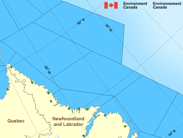
Funk Island Bank
Forecast
Marine Forecast
Issued 03:00 AM NDT 21 May 2024
Today Tonight and Wednesday.
Wind south 15 to 20 knots veering to southwest 10 to 15 this morning then to west 10 to 15 Wednesday morning. Wind veering to northwest 20 Wednesday afternoon.
Showers tonight and Wednesday morning. Fog banks forming this morning and dissipating Wednesday afternoon.
Waves
Issued 06:00 AM NDT 21 May 2024
Today Tonight and Wednesday.
Seas 1 to 2 metres building to 2 to 3 Wednesday
evening.
Extended Forecast
Issued 03:00 AM NDT 21 May 2024
Thursday
Wind northwest 25 knots diminishing to north
15 in the afternoon.
Friday
Wind variable 10 to 15 knots.
Saturday
Wind east 15 to 20 knots.
Ice Forecast
Stay connected
Weather Conditions
Zoom-in to make a selection

Legend:
Ice Conditions
Ice Forecasts
Funk Island Bank
Issued 10:00 AM EDT 20 May 2024 Today Tonight and TuesdayIce Edge
Ice edge estimated from Labrador near 5335N 5602W to 5428N 5230W to5655N 5742W to 5924N 5853W to 6200N 6045W then northeastward. Sea
ice west of the ice edge.
Ice Coverage
Bergy water.
Ice Forecasts
Southeast Labrador Sea
Issued 10:00 AM EDT 20 May 2024 Today Tonight and TuesdayIce Edge
Ice edge estimated from Labrador near 5335N 5602W to 5428N 5230W to5655N 5742W to 5924N 5853W to 6200N 6045W then northeastward. Sea
ice west of the ice edge.
Ice Coverage
Forecasts available to mariners upon request.
Iceberg Bulletin
Funk Island Bank
Issued 2:43 PM EDT 20 May 2024Iceberg Limit
Iceberg limit at 0000 UTC 21 May estimated from Newfoundland near4646N 5304W to 4655N 4935W to 4820N 4635W to 5415N 4740W to 5740N
5210W to 5710N 4755W then eastwards.
Western iceberg limit at 0000 UTC 21 May estimated from Quebec near
5009N 6138W to Newfoundland near 4739N 5916W.
Iceberg Count
26 to 50 icebergs.Iceberg Bulletin
Southeast Labrador Sea
Issued 2:43 PM EDT 20 May 2024Iceberg Limit
Iceberg limit at 0000 UTC 21 May estimated from Newfoundland near4646N 5304W to 4655N 4935W to 4820N 4635W to 5415N 4740W to 5740N
5210W to 5710N 4755W then eastwards.
Western iceberg limit at 0000 UTC 21 May estimated from Quebec near
5009N 6138W to Newfoundland near 4739N 5916W.
Iceberg Count
Forecasts available to mariners upon request.Warnings
No watches or warnings in effect.
Synopsis
Technical Marine Synopsis
Issued 3:00 AM NDT 21 May 2024 Today Tonight and Wednesday At 3:00 a.m. NDT today trough located on a line east-west oversouthern Labrador Coast.
By 3:00 a.m. NDT Wednesday trough located on a line
northeast-southwest over Funk Island Bank.
At 3:00 a.m. NDT today low 1007 mb located south of Laurentian Fan.
By 3:00 a.m. NDT Wednesday low 1005 mb located southeast of the
Grand Banks.
At 3:00 a.m. NDT today ridge located on a line northeast-southwest
over the Avalon Peninsula.
By 3:00 a.m. NDT Wednesday ridge located on a line
northeast-southwest over the Grand Banks.
Atlantic - Labrador Area
Another Region
- Date modified:
 ATOM
ATOM