
Puvirnituq - southern half
Forecast
Marine Forecast
Issued 05:00 AM CST 05 November 2026
Today Tonight and Friday.
Gale warning in effect.
Wind north 20 knots diminishing to north 15 this morning then backing to west 15 near midnight. Wind increasing to west 20 late overnight and to southwest 30 near noon Friday. Wind increasing to southwest 35 Friday evening.
Temperatures near plus 1.
Waves
Extended Forecast
Ice Forecast
Stay connected
 ATOM
Weather Conditions
Zoom-in to make a selection
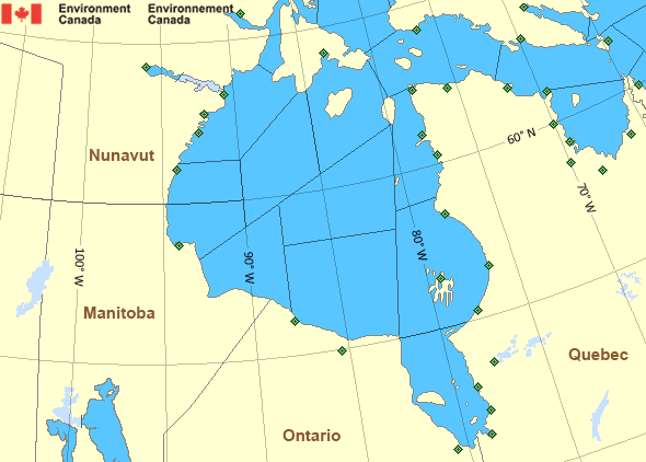
 Buoy
 Land Station
Ice Conditions
Ice Forecasts
Issued 11:00 AM EST 5 November 2026 Today Tonight and FridayIce Edge
First ice edge estimated from Quebec near 5903N 6546W to 5854N 6735Wto 5928N 6909W to 6106N 6901W to 6249N 7412W to 6232N 8013W to 6136N
8037W to Quebec near 5926N 7756W. Sea ice south then east of the ice
edge.
Second ice edge estimated from Ontario near 5510N 8221W to 5909N
9349W to 6156N 9218W to 6343N 8806W to 6147N 8310W to 6346N 7938W to
6520N 8308W to Nunavut near 6700N 8130W. Sea ice west of the ice
edge.
Third ice edge estimated from Nunavut near 6728N 8112W to 6804N
8018W to 6550N 7536W to 6535N 7831W to Baffin Island near 6443N
7818W. Sea ice north then east of the ice edge.
Ice Coverage
Bergy water except 2 tenths new ice along parts of the Quebec coast.
Warnings
Warnings (In effect)
Gale warning in effect
Puvirnituq - southern half
Issued 05:00 AM CST 05 November 2026'Gale' force winds of 34 to 47 knots are occurring or expected to occur in this marine area. Watch for updated statements. Please refer to the latest marine forecasts for further details and continue to monitor the situation through Canadian Coast Guard radio.
Synopsis
Technical Marine Synopsis
Issued 4:45 AM EST 5 November 2026 Today Tonight and Friday At 1200 UTC Thursday trough located on a line north-south overBaffin Island.
By 0000 UTC Saturday low 988 mb located at 69N 61W.
At 1200 UTC Thursday ridge from 1024 mb high located from Manitoba
to Hudson Strait.
By 0000 UTC Saturday ridge from 1027 mb high located from Quebec
to Davis Strait.
By 0000 UTC Saturday low 988 mb located at 64N 88W.
Hudson - Hudson Bay Area
- Arviat - eastern half
- Arviat - western half
- Baker
- Belcher - northern half
- Belcher - southern half
- Central - eastern half
- Central - western half
- Churchill - eastern half
- Churchill - western half
- Coats - northern half
- Coats - southern half
- East Foxe
- Frobisher Bay
- James Bay - northern half
- James Bay - southern half
- Lake Winnipegosis
- Lake Winnipeg - north basin
- Northwest Labrador Sea
- North Labrador Coast
- Nottingham - eastern half
- Nottingham - western half
- Puvirnituq - northern half
- Puvirnituq - southern half
- Rankin - northern half
- Rankin - southern half
- Resolution - eastern half
- Resolution - western half
- Roes Welcome - northern half
- Roes Welcome - southern half
- South Hudson
- South-central Hudson
- Ungava - eastern half
- Ungava - western half
- West Brevoort - southern half
- West Foxe
- York
Another Region
Features
View yesterday's weather data

Check out weather conditions from the previous day using the Past Data link on each location page.
- Date modified: