
Nottingham - western half
Forecast
Marine Forecast
Issued 05:30 PM EDT 04 September 2026
Tonight and Saturday.
Wind light increasing to southwest 15 knots this evening and to southwest 20 late overnight. Wind increasing to south 30 Saturday evening.
Showers Saturday evening. Fog banks dissipating Saturday afternoon.
Waves
Issued 05:30 PM EDT 04 September 2026
Tonight and Saturday.
Seas 1 metre or less building to 2 Saturday morning and to 3
Saturday evening.
Extended Forecast
Issued 05:30 PM EDT 04 September 2026
Sunday
Wind south 30 knots diminishing to west 20 in
the morning.
Monday
Wind west 20 knots.
Tuesday
Wind west 15 knots backing to southwest
20.
Ice Forecast
Issued 11:00 AM EDT 4 September 2026 Today Tonight and Saturday Bergy water.These are the last forecasts until further request.
Stay connected
 ATOM
ATOMWeather Conditions
Zoom-in to make a selection
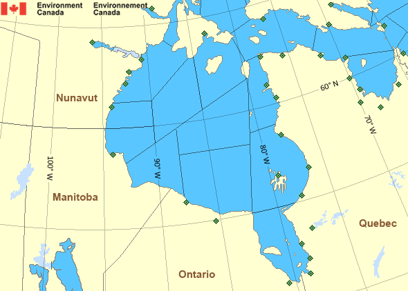
Legend:
 Buoy
Buoy  Land Station
 Ice Conditions
Ice Forecasts
Issued 11:00 AM EDT 4 September 2026 Today Tonight and SaturdayIce Edge
Ice edge is outside the forecast region.Ice Coverage
Bergy water.
Warnings
No watches or warnings in effect.
Synopsis
Technical Marine Synopsis
Issued 4:45 PM EDT 4 September 2026 Tonight and Saturday At 0000 UTC Saturday cold front from 997 mb low located from 69N88W to 55N 108W.
By 0000 UTC Sunday cold front from 990 mb low located from 76N
62W to 54N 87W.
Hudson - Hudson Bay Area
Another Region
Features
Colour-coded weather alerts

Learn more about weather alerting in Canada
Improved storm alerts

Learn more about targeted warnings for severe thunderstorms and tornadoes
- Date modified: