
Coats - northern half
Forecast
Marine Forecast
Issued 05:00 AM CDT 13 July 2026
Today Tonight and Tuesday.
Wind light increasing to southeast 20 knots early this evening then backing to northeast 20 near midnight. Wind increasing to northeast 25 Tuesday morning then diminishing to northeast 15 Tuesday afternoon.
Showers Tuesday morning.
Waves
Issued 05:00 AM CDT 13 July 2026
Today Tonight and Tuesday.
Seas 1 metre or less.
Extended Forecast
Issued 05:00 AM CDT 13 July 2026
Wednesday
Wind northeast 20 knots increasing to
northeast 25 in the morning then diminishing to light in the
afternoon.
Thursday
Wind northeast 15 knots diminishing to
light.
Friday
Wind light.
Ice Forecast
Stay connected
 ATOM
ATOMWeather Conditions
Zoom-in to make a selection
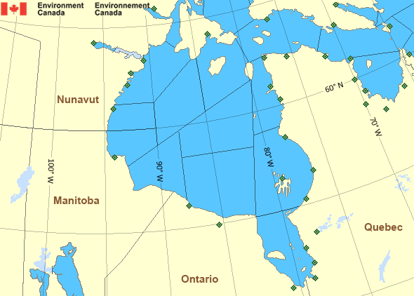
Legend:
 Buoy
Buoy  Land Station
 Ice Conditions
Ice Forecasts
Issued 11:00 AM EDT 12 July 2026 Today Tonight and MondayIce Edge
First ice edge estimated from Quebec near 6416N 7322W to 6300N 7733Wto 6225N 8113W to 6105N 8240W to 5807N 7839W to Baffin Island near
5747N 7658W. Sea ice west of the ice edge.
Second ice edge estimated from Baffin Island near 6222N 6858W to
6029N 6649W to 6108N 6307W then northeastward. Sea ice north of the
ice edge.
Ice Coverage
Bergy water.
Warnings
No watches or warnings in effect.
Synopsis
Technical Marine Synopsis
Issued 4:45 AM EDT 13 July 2026 Today Tonight and Tuesday At 1200 UTC Monday dissipating low 1001 mb located at 75N 65W.At 1200 UTC Monday trough from 997 mb low located from 59N 87W to
67N 104W.
By 0000 UTC Wednesday trough from 988 mb low located from 57N 78W
to 64N 88W.
Hudson - Hudson Bay Area
Another Region
Features
Colour-coded weather alerts

Learn more about weather alerting in Canada
Thunderstorm Outlooks

Find the Thunderstorm Outlook for your area.
- Date modified: