Prince Alfred
Forecast
Marine Forecast
Issued 05:30 PM EDT 12 October 2024
Tonight and Sunday.
Wind light increasing to southeast 15 knots early this evening and to southeast 20 late this evening. Wind increasing to east 30 late Sunday morning then diminishing to southeast 15 Sunday evening.
Periods of snow. Visibility 1 mile or less in snow.
Temperatures near zero.
Waves
Issued 05:30 PM EDT 12 October 2024
Tonight and Sunday.
Seas 1 metre or less building to 2 late overnight and to 3 early
Sunday morning.
Extended Forecast
Issued 05:30 PM EDT 12 October 2024
Monday
Wind southwest 20 knots increasing to west 30
in the afternoon.
Tuesday
Wind west 30 knots diminishing to west
20.
Wednesday
Wind northwest 25 knots diminishing to light
late in the day.
Ice Forecast
Stay connected
Weather Conditions
Zoom-in to make a selection
Legend:
Buoy
Land Station
Ice Conditions
Ice Forecasts
Issued 10:00 AM EDT 12 October 2024 Today Tonight and SundayIce Edge
First ice edge estimated from Northwest Territories near 7026N12812W to 6930N 13723W to 7004N 14100W then westward. Sea ice south
of the ice edge.
Second ice edge estimated from 7430N 13719W to 7355N 13451W to Banks
Island near 7405N 12427W. Sea ice north of the ice edge.
Third ice edge estimated from Prince of Wales Island near 7323N
9708W to 7324N 9635W to 7335N 9628W to Prince of Wales Island near
7340N 9657W. Sea ice west of the ice edge.
Fourth ice edge estimated from Somerset Island near 7158N 9509W to
Nunavut near 7157N 9509W. Sea ice east of the ice edge.
Fifth ice edge estimated from Brodeur Peninsula near 7345N 8732W to
Somerset Island near 7352N 9013W. Sea ice south of the ice edge.
Ice Coverage
Bergy water.
Warnings
No watches or warnings in effect.
Synopsis
Technical Marine Synopsis
Issued 6:30 PM MDT 12 October 2024 Tonight and Sunday By 0000 UTC Monday low 981 mb located at 72N 130W.
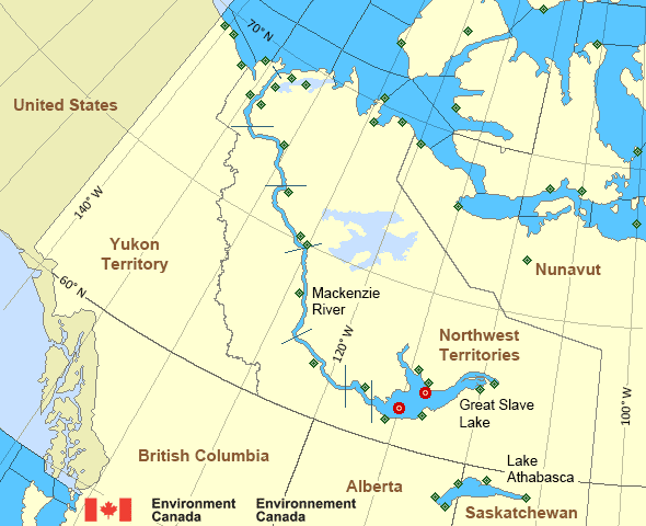
Mackenzie - Mackenzie River Area
- Amundsen
- Axe Point mile 91 to Camsell Bend mile 290
- Baillie
- Banks
- Bathurst
- Bowie
- Byam
- Camsell Bend mile 290 to Tulita mile 512
- Coronation
- Dease
- Dixon Entrance East
- Dixon Entrance West - east of Langara
- Dixon Entrance West - west of Langara
- Dolphin
- Fort Good Hope mile 684 to Point Separation mile 913
- Great Slave Lake - basin
- Great Slave Lake - east arm
- Great Slave Lake - north arm
- Hecate Strait - northern half
- Lake Athabasca - eastern half
- Lake Athabasca - western half
- Larsen
- Mackenzie
- Maud
- McClintock
- McClure
- Melville
- North Mackenzie
- North Tuktoyaktuk
- Point Separation mile 913 to Kittigazuit Bay mile 1081
- Prince Alfred
- Prince of Wales
- Rae
- Tuktoyaktuk - northern half
- Tuktoyaktuk - southern half
- Tulita mile 512 to Fort Good Hope mile 684
- Ulukhaktok
- West Coast Haida Gwaii - northern half
- Wrigley Harbour mile 0 to Axe Point mile 91
- Yukon Coast
Another Region
Features
New Predicting and Alerting Coastal Flooding Program
Find out about coastal flooding coverage, forecasts and warnings in your region
- Date modified: