Melville
Forecast
Issued 05:30 PM EDT 24 October 2024
Forecasts are unavailable until further request.
Stay connected
Weather Conditions
Zoom-in to make a selection

Legend:
Ice Conditions
Ice Forecasts
Issued 11:00 AM EDT 24 October 2024 Today Tonight and FridayIce Edge
Ice edge estimated from Baffin Island near 6924N 6700W to 7015N6700W to 7200N 7315W to 7430N 7403W to 7424N 7728W to 7549N 7401W
then northeastward. Sea ice north and west of the ice edge.
Ice Coverage
Forecasts available to mariners upon request.
Warnings
No watches or warnings in effect.
Synopsis
Technical Marine Synopsis
Issued 6:30 PM MDT 24 October 2024 Tonight and Friday At 0000 UTC Friday trough located from 75N 67W to 73N 108W.By 0000 UTC Saturday trough located from 75N 67W to 71N 94W.
At 0000 UTC Friday dissipating low 991 mb located at 71N 121W.
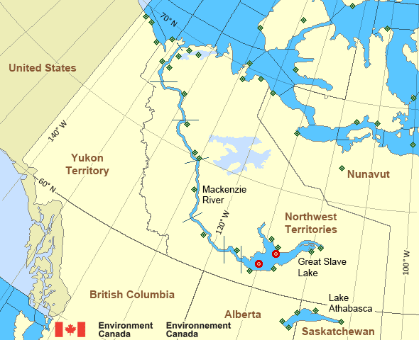
Mackenzie - Mackenzie River Area
- Amundsen
- Axe Point mile 91 to Camsell Bend mile 290
- Baillie
- Banks
- Bathurst
- Bowie - northern half
- Byam
- Camsell Bend mile 290 to Tulita mile 512
- Coronation
- Dease
- Dixon Entrance East
- Dixon Entrance West - east of Langara
- Dixon Entrance West - west of Langara
- Dolphin
- Fort Good Hope mile 684 to Point Separation mile 913
- Great Slave Lake - basin
- Great Slave Lake - east arm
- Great Slave Lake - north arm
- Hecate Strait
- Lake Athabasca - eastern half
- Lake Athabasca - western half
- Larsen
- Mackenzie
- Maud
- McClintock
- McClure
- Melville
- North Mackenzie
- North Tuktoyaktuk
- Point Separation mile 913 to Kittigazuit Bay mile 1081
- Prince Alfred
- Prince of Wales
- Rae
- Tuktoyaktuk - northern half
- Tuktoyaktuk - southern half
- Tulita mile 512 to Fort Good Hope mile 684
- Ulukhaktok
- West Coast Haida Gwaii - northern half
- Wrigley Harbour mile 0 to Axe Point mile 91
- Yukon Coast
Another Region
Features
WeatherCAN

Download and use the WeatherCAN app on your mobile device
- Date modified:
 ATOM
ATOM