Language selection

Weather shortcuts

Coronation

Forecast

Marine Forecast

Issued 07:00 PM MDT 12 October 2024

Tonight and Sunday.

Wind light increasing to southeast 15 knots near midnight and to southeast 20 late overnight. Wind increasing to south 30 near noon Sunday.

Scattered showers Sunday.

Waves

Issued 07:00 PM MDT 12 October 2024
Tonight and Sunday. Seas 1 metre or less building to 2 Sunday morning.

Extended Forecast

Issued 07:00 PM MDT 12 October 2024
Monday Wind southwest 20 knots diminishing to light in the morning.
Tuesday Wind north 25 knots diminishing to northwest 15 late in the day.
Wednesday Wind northwest 15 knots diminishing to light late in the day.

Ice Forecast

Issued 10:00 AM EDT 12 October 2024 Today Tonight and Sunday Ice free. 

[ Canadian Ice Service ]

Stay connected

ATOM

Weather Conditions

Skip Image

Zoom-in to make a selection

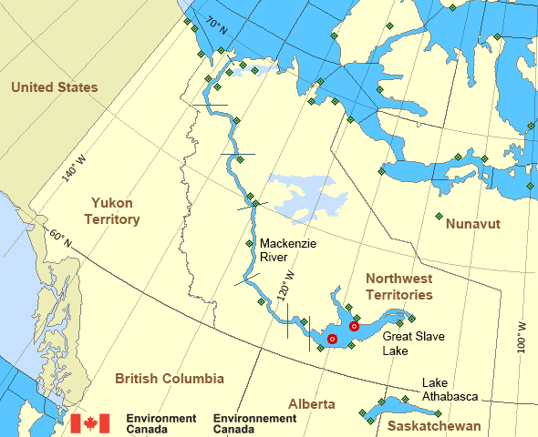
Map of Mackenzie - Mackenzie River marine weather areas Great Slave Lake - 45141 Great Slave Lake North Arm - 45150 Herschel Island Komakuk Beach Shingle Point Airport Aklavik Airport Cape Parry Airport Fort Good Hope Airport Tulita Airport Fort Providence Fort Reliance Fort Resolution Airport Fort Simpson Airport Hay River/Merlyn Carter Airport Inner Whaleback Rocks Inuvik Airport Keats Point Lutselke Airport Norman Wells Airport Paulatuk Airport Pelly Island Tuktoyaktuk Airport Wrigley Airport Yellowknife Airport Liverpool Bay Little Chicago Storm Hills Bathurst Inlet Kugluktuk Airport Hat Island Croker River Cambridge Bay Airport Cape Peel West Gateshead Island Stefansson Island Cape Providence Ulukhaktok Airport Sachs Harbour Airport Thomsen River Prairie River Egg Island Fort Chipewyan Airport Stony Rapids Airport Uranium City
Legend:
buoy Buoy
land station Land Station
Ice Conditions

Ice Forecasts

Issued 10:00 AM EDT 12 October 2024 Today Tonight and Sunday

Ice Edge

First ice edge estimated from Northwest Territories near 7026N
12812W to 6930N 13723W to 7004N 14100W then westward. Sea ice south
of the ice edge.

Second ice edge estimated from 7430N 13719W to 7355N 13451W to Banks
Island near 7405N 12427W. Sea ice north of the ice edge.

Third ice edge estimated from Prince of Wales Island near 7323N
9708W to 7324N 9635W to 7335N 9628W to Prince of Wales Island near
7340N 9657W. Sea ice west of the ice edge.

Fourth ice edge estimated from Somerset Island near 7158N 9509W to
Nunavut near 7157N 9509W. Sea ice east of the ice edge.

Fifth ice edge estimated from Brodeur Peninsula near 7345N 8732W to
Somerset Island near 7352N 9013W. Sea ice south of the ice edge.

Ice Coverage

Ice free.

Warnings

No watches or warnings in effect.

Synopsis

Technical Marine Synopsis

Issued 6:30 PM MDT 12 October 2024 Tonight and Sunday At 0000 UTC Sunday quasi-stationary trough located on a line
north-south over eastern Baffin Bay.

At 0000 UTC Sunday ridge located from 67N 107W to 76N 109W.
By 0000 UTC Monday ridge located from 67N 93W to 78N 96W.

By 0000 UTC Monday low 981 mb located at 72N 130W.

Mackenzie - Mackenzie River Area

Another Region

Features

New Predicting and Alerting Coastal Flooding Program

Find out about coastal flooding coverage, forecasts and warnings in your region

Date modified: