
Northwest Labrador Sea
Forecast
Marine Forecast
Issued 09:30 AM NDT 23 May 2024
Today Tonight and Friday.
Wind north 10 to 15 knots diminishing to light near noon. Wind light tonight and Friday.
Flurries ending this afternoon.
Temperatures near zero.
Waves
Issued 06:00 AM NDT 23 May 2024
Today Tonight and Friday.
Outside the ice edge seas 1 metre or less.
Extended Forecast
Issued 04:00 AM NDT 23 May 2024
Saturday
Wind light becoming northwest 10 to 15 knots
in the afternoon.
Sunday
Wind northwest 10 to 15 knots backing to
southwest 15 to 20.
Monday
Wind southwest 15 knots.
Ice Forecast
Issued 10:00 AM EDT 23 May 2024 Today Tonight and Friday Bergy water except 6 tenths first-year ice including a trace of old
ice in the extreme western section.
Stay connected
 ATOM
ATOMWeather Conditions
Zoom-in to make a selection
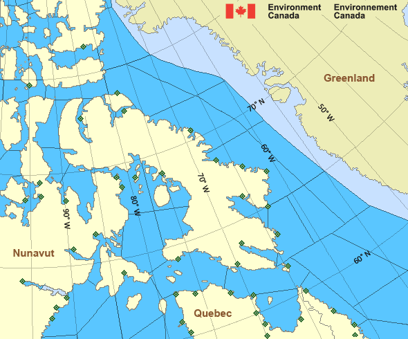
Legend:
 Buoy
Buoy  Land Station
 Ice Conditions
Ice Forecasts
Issued 10:00 AM EDT 23 May 2024 Today Tonight and FridayIce Edge
Ice edge estimated from Labrador near 5343N 5624W to 5315N 5227W to5434N 5248W to 5645N 5710W to 6000N 5859W to 6130N 6145W to 6200N
6045W then northeastward. Sea ice north then west of the ice edge.
Ice Coverage
Bergy water except 6 tenths first-year ice including a trace of old
ice in the extreme western section.
Iceberg Bulletin
Issued 2:30 PM EDT 22 May 2024Iceberg Limit
Iceberg limit at 0000 UTC 23 May estimated from Newfoundland near4646N 5304W to 4640N 5100W to 4810N 4625W to 5415N 4740W to 5740N
5210W to 5725N 5045W to 5755N 4555W then eastwards.
Western iceberg limit at 0000 UTC 23 May estimated from Quebec near
5014N 6127W to Newfoundland near 4800N 5909W.
Iceberg Count
Unknown number of icebergs.Warnings
No watches or warnings in effect.
Synopsis
Technical Marine Synopsis
Issued 9:30 AM NDT 23 May 2024 Today Tonight and Friday At 9:30 a.m. NDT today ridge located on a line northwest-southeastover the North Labrador Coast.
By 9:30 p.m. NDT tonight quasi-stationary ridge located on a line
northwest-southeast over Labrador Sea.
Arctic - Eastern Arctic Area
- Admiralty
- Arviat - eastern half
- Arviat - western half
- Baker
- Barrow
- Boothia
- Byam
- Central Brevoort - northern half
- Central Brevoort - southern half
- Central - eastern half
- Central - western half
- Clarence - northern half
- Clarence - southern half
- Coats - northern half
- Coats - southern half
- Committee
- Cumberland
- East Baffin - northern half
- East Baffin - southern half
- East Brevoort
- East Clyde
- East Davis - northern half
- East Davis - southern half
- East Foxe
- East Labrador Sea
- Eureka - southern half
- Frobisher Bay
- Hassel
- Igloolik
- Jones - eastern half
- Jones - western half
- Kane - southern half
- Lancaster - eastern half
- Lancaster - western half
- Larsen
- Maclean
- Massey
- Maud
- McClintock
- Mid Labrador Coast
- Navy Board
- Northwest Labrador Sea
- North Labrador Coast
- Norwegian
- Nottingham - eastern half
- Nottingham - western half
- Peary
- Peel
- Pond
- Prince Charles
- Puvirnituq - northern half
- Puvirnituq - southern half
- Queens
- Rae
- Rankin - northern half
- Rankin - southern half
- Regent
- Resolution - eastern half
- Resolution - western half
- Roes Welcome - northern half
- Roes Welcome - southern half
- South Labrador Sea
- South Sverdrup
- South-central Hudson - eastern half
- St. Roch
- Ungava - eastern half
- Ungava - western half
- West Baffin - northern half
- West Baffin - southern half
- West Brevoort - northern half
- West Brevoort - southern half
- West Clyde - northern half
- West Clyde - southern half
- West Davis - northern half
- West Davis - southern half
- West Foxe
Another Region
Features
New Predicting and Alerting Coastal Flooding Program

Find out about coastal flooding coverage, forecasts and warnings in your region
- Date modified: