
East Labrador Sea
Forecast
Marine Forecast
Issued 09:30 AM NDT 16 October 2026
Today Tonight and Saturday.
Storm warning in effect.
Wind northwest 25 to 35 knots increasing to northwest 45 to 55 this afternoon except northwest 25 to 35 over northern sections. Wind diminishing to northwest 25 to 35 early Saturday morning then becoming northwest 25 Saturday afternoon. Wind veering to north 15 to 20 Saturday evening.
Showers.
Waves
Issued 06:00 AM NDT 16 October 2026
Today Tonight and Saturday.
Seas 2 metres building to 3 to 5 this morning except 5 to 7 over
southern sections tonight and Saturday morning.
Extended Forecast
Issued 04:00 AM NDT 16 October 2026
Sunday
Wind north 15 to 20 knots backing to northwest
25 in the morning.
Monday
Wind northwest 25 to 35 knots becoming
southwest 25.
Tuesday
Wind southwest 25 knots increasing to
northwest 25 to 35.
Stay connected
 ATOM
Weather Conditions
Zoom-in to make a selection
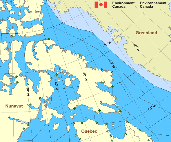
Legend:
 Buoy
 Land Station
Ice Conditions
Ice Forecasts
Issued 10:00 AM EDT 7 August 2026 Forecasts have ended for the season.Iceberg Bulletin
Issued 2:30 PM EDT 15 October 2026Iceberg Limit
Iceberg limit at 0000 UTC 16 Oct estimated from Newfoundland near4840N 5340W to 5130N 4945W to 5245N 4945W to 6000N 5800W to 6125N
5445W to 6000N 5000W then eastward.
Iceberg Count
Unknown number of icebergs.Warnings
Warnings (In effect)
Storm warning in effect
East Labrador Sea
Issued 09:30 AM NDT 16 October 2026'Storm' force winds of 48 to 63 knots are occurring or expected to occur in this marine area. Please refer to the latest marine forecasts for further details and continue to monitor the situation through Canadian Coast Guard radio.
Synopsis
Technical Marine Synopsis
Issued 9:30 AM NDT 16 October 2026 Today Tonight and Saturday At 9:30 a.m. NDT today low 975 mb located east of Funk Island Bank.By 9:30 a.m. NDT Saturday low 970 mb located southeast of Greenland.
At 9:30 a.m. NDT today trough located east of the East Labrador Sea.
By 4:00 p.m. NDT today merging trough located east of Labrador Sea.
At 9:30 a.m. NDT today ridge located on a line north-south over
western Labrador.
By 9:30 a.m. NDT Saturday ridge located on a line
northwest-southeast over the South Labrador Sea.
Marine Weather Statement
Issued 9:22 AM NDT 16 October 2026 A low pressure system will pass southeast of the district todaybefore moving to lie south of Greenland overnight tonight. Meanwhile,
a trough of low pressure over the East Labrador Sea will continue to
move eastwards before merging with the low later today. Strong to
gale force northerlies to northwesterlies in the wake of these
features will diminish tonight and Saturday as the low moves away and
a ridge of high pressure builds in from the west.
Marine interests are advised that a storm warning is in effect for
East Labrador Sea. Gale warnings are in effect for all remaining
waters except Lake Melville and North Labrador Coast.
Arctic - Eastern Arctic Area
- Admiralty
- Arviat
- Baker
- Barrow
- Boothia
- Byam
- Central
- Central Brevoort - northern half
- Central Brevoort - southern half
- Clarence - northern half
- Clarence - southern half
- Coats
- Committee
- Cumberland
- East Baffin - northern half
- East Baffin - southern half
- East Brevoort - northern half
- East Brevoort - southern half
- East Clyde - northern half
- East Clyde - southern half
- East Davis - northern half
- East Davis - southern half
- East Foxe
- East Labrador Sea
- Eureka - southern half
- Frobisher Bay
- Hassel
- Igloolik
- Jones - eastern half
- Jones - western half
- Kane - southern half
- Lancaster - eastern half
- Lancaster - western half
- Larsen
- Maclean
- Massey
- Maud
- McClintock
- Mid Labrador Coast
- Navy Board
- Northwest Labrador Sea
- North Labrador Coast
- Norwegian
- Nottingham - eastern half
- Nottingham - western half
- Peary
- Peel
- Pond
- Prince Charles
- Puvirnituq
- Queens
- Rae
- Rankin
- Regent
- Resolution - eastern half
- Resolution - western half
- Roes Welcome
- South Labrador Sea
- South Sverdrup
- South-central Hudson
- St. Roch
- Ungava - eastern half
- Ungava - western half
- West Baffin - northern half
- West Baffin - southern half
- West Brevoort - northern half
- West Brevoort - southern half
- West Clyde - northern half
- West Clyde - southern half
- West Davis - northern half
- West Davis - southern half
- West Foxe
Another Region
- Date modified: