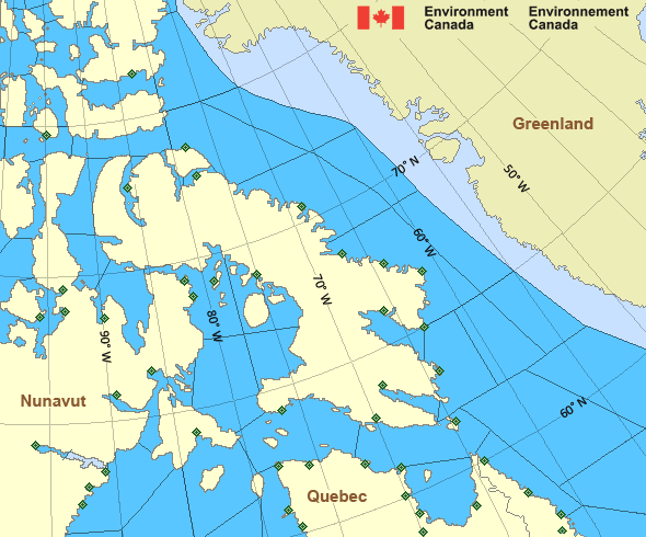
Clarence - southern half
Forecast
Marine Forecast
Issued 05:30 PM EDT 26 July 2024
Tonight and Saturday.
Wind northwest 20 knots diminishing to northwest 15 late this evening and to light after midnight. Wind becoming east 15 Saturday evening.
Showers beginning near midnight changing to flurries after midnight then to showers or flurries Saturday afternoon. Visibility 1 mile or less in precipitation.
Waves
Extended Forecast
Ice Forecast
Stay connected
Weather Conditions
Zoom-in to make a selection

Ice Conditions
Ice Forecasts
Issued 11:00 AM EDT 26 July 2024 Today Tonight and SaturdayIce Edge
Ice edge estimated from Baffin Island near 6358N 6439W to 6324N6157W to 6350N 5922W to 6610N 5740W then northward. Sea ice north
then northwest of the ice edge.
Ice Coverage
Special ice warning in effect.1 tenth old ice except 3 tenths old ice in the northwestern section.
Consolidated first-year ice including 3 tenths old ice along parts
of the coasts. Unusual presence of old ice in the southern section
today and continuing Saturday.
Warnings
Warnings (In effect)
Special ice warning in effect
Clarence
Issued 11:00 AM EDT 26 July 2024Navigators in this marine area should be on the lookout for hazardous ice conditions and take necessary safety precautions. Please refer to the latest ice forecasts for further details and continue to monitor the situation through Canadian Coast Guard radio stations.
Synopsis
Technical Marine Synopsis
Issued 6:30 PM MDT 26 July 2024 Tonight and Saturday At 0000 UTC Saturday dissipating ridge located from 74N 92W to67N 96W.
At 0000 UTC Saturday trough from 995 mb low located from 73N 106W
to 69N 107W.
By 0000 UTC Sunday trough from 980 mb low located from 71N 80W to
68N 78W then to 65N 90W.
At 0000 UTC Sunday approaching ridge located from 74N 120W to
67N 92W.
Arctic - Eastern Arctic Area
- Admiralty
- Arviat - eastern half
- Arviat - western half
- Baker
- Barrow
- Boothia
- Byam
- Central Brevoort - northern half
- Central Brevoort - southern half
- Central - eastern half
- Central - western half
- Clarence - northern half
- Clarence - southern half
- Coats - northern half
- Coats - southern half
- Committee
- Cumberland
- East Baffin - northern half
- East Baffin - southern half
- East Brevoort - northern half
- East Brevoort - southern half
- East Clyde - northern half
- East Clyde - southern half
- East Davis - northern half
- East Davis - southern half
- East Foxe
- East Labrador Sea
- Eureka - southern half
- Frobisher Bay
- Hassel
- Igloolik
- Jones - eastern half
- Jones - western half
- Kane - southern half
- Lancaster - eastern half
- Lancaster - western half
- Larsen
- Maclean
- Massey
- Maud
- McClintock
- Mid Labrador Coast
- Navy Board
- Northwest Labrador Sea - northern half
- Northwest Labrador Sea - southern half
- North Labrador Coast - north of Saglek
- North Labrador Coast - Saglek and south
- Norwegian
- Nottingham - eastern half
- Nottingham - western half
- Peary
- Peel
- Pond
- Prince Charles
- Puvirnituq - northern half
- Puvirnituq - southern half
- Queens
- Rae
- Rankin - northern half
- Rankin - southern half
- Regent
- Resolution - eastern half
- Resolution - western half
- Roes Welcome - northern half
- Roes Welcome - southern half
- South Labrador Sea
- South Sverdrup
- South-central Hudson - eastern half
- St. Roch
- Ungava
- West Baffin - northern half
- West Baffin - southern half
- West Brevoort - northern half
- West Brevoort - southern half
- West Clyde - northern half
- West Clyde - southern half
- West Davis - northern half
- West Davis - southern half
- West Foxe
Another Region
Features
New Predicting and Alerting Coastal Flooding Program

Find out about coastal flooding coverage, forecasts and warnings in your region
- Date modified:
 ATOM
ATOM