
Central - western half
Forecast
Marine Forecast
Issued 05:00 PM CDT 13 October 2026
Tonight and Wednesday.
Gale warning in effect.
Wind southwest 25 knots increasing to northwest 35 near midnight then diminishing to north 30 early Wednesday morning.
Scattered showers changing to scattered flurries Wednesday morning and ending near noon Wednesday.
Waves
Issued 05:00 PM CDT 13 October 2026
Tonight and Wednesday.
Seas 3 to 4 metres building to 4 to 6 near
midnight.
Extended Forecast
Issued 05:00 PM CDT 13 October 2026
Thursday
Wind west 20 knots increasing to northwest 30
late in the day.
Friday
Wind northwest 35 knots diminishing to
northwest 30.
Saturday
Wind north 30 knots diminishing to south
20.
Ice Forecast
Issued 11:00 AM EDT 13 October 2026 Today Tonight and Wednesday Forecasts available to mariners upon request.
Stay connected
 ATOM
Weather Conditions
Zoom-in to make a selection
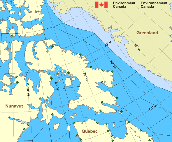
Legend:
 Buoy
 Land Station
Ice Conditions
Ice Forecasts
Issued 11:00 AM EDT 13 October 2026 Today Tonight and WednesdayIce Edge
First ice edge estimated from Nunavut near 6602N 8557W toSouthampton Island near 6555N 8535W. Sea ice north of the ice edge.
Second ice edge estimated from Southampton Island near 6528N 8430W
to 6537N 8305W to Nunavut near 6621N 8324W. Sea ice southwest of the
ice edge.
Third ice edge estimated from Nunavut near 6812N 8158W to 6917N
7955W to 6810N 7928W to 6705N 7717W to Baffin Island near 6632N
7328W. Sea ice west then northeast of the ice edge.
Ice Coverage
Forecasts available to mariners upon request.
Warnings
Warnings (In effect)
Gale warning in effect
Central - western half
Issued 5:00 PM CDT 13 October 2026'Gale' force winds of 34 to 47 knots are occurring or expected to occur in this marine area. Watch for updated statements. Please refer to the latest marine forecasts for further details and continue to monitor the situation through Canadian Coast Guard radio.
Synopsis
Technical Marine Synopsis
Issued 4:45 PM EDT 13 October 2026 Tonight and Wednesday At 0000 UTC Wednesday low 993 mb located at 64N 88W.By 0000 UTC Thursday low 988 mb located at 66N 72W.
Arctic - Eastern Arctic Area
- Admiralty
- Arviat
- Baker
- Barrow
- Boothia
- Byam
- Central Brevoort
- Central - eastern half
- Central - western half
- Clarence - northern half
- Clarence - southern half
- Coats - northern half
- Coats - southern half
- Committee
- Cumberland
- East Baffin - northern half
- East Baffin - southern half
- East Brevoort
- East Clyde
- East Davis - northern half
- East Davis - southern half
- East Foxe
- East Labrador Sea
- Eureka - southern half
- Frobisher Bay
- Hassel
- Igloolik
- Jones
- Kane - southern half
- Lancaster - eastern half
- Lancaster - western half
- Larsen
- Maclean
- Massey
- Maud
- McClintock
- Mid Labrador Coast
- Navy Board
- Northwest Labrador Sea
- North Labrador Coast
- Norwegian
- Nottingham - eastern half
- Nottingham - western half
- Peary
- Peel
- Pond
- Prince Charles
- Puvirnituq - northern half
- Puvirnituq - southern half
- Queens
- Rae
- Rankin - northern half
- Rankin - southern half
- Regent
- Resolution - eastern half
- Resolution - western half
- Roes Welcome
- South Labrador Sea
- South Sverdrup
- South-central Hudson
- St. Roch
- Ungava
- West Baffin - northern half
- West Baffin - southern half
- West Brevoort
- West Clyde
- West Davis - northern half
- West Davis - southern half
- West Foxe
Another Region
- Date modified: