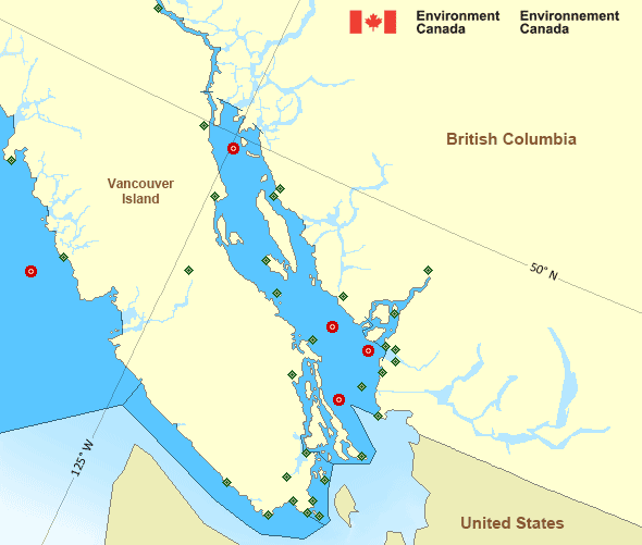
Strait of Georgia - south of Nanaimo
Forecast
Marine Forecast
Issued 04:00 AM PDT 27 April 2024
Today Tonight and Sunday.
Wind southerly 5 to 15 knots increasing to southeast 15 to 20 this afternoon then diminishing to south 5 to 15 Sunday morning. Wind becoming southwest 10 to 20 Sunday afternoon.
Showers.
Extended Forecast
Issued 04:00 AM PDT 27 April 2024
Monday
Wind northwest 5 to 15 knots becoming southeast
10 to 20 in the afternoon.
Tuesday
Wind southeast 10 to 20 knots becoming
northwest 10 to 15.
Wednesday
Wind light becoming southeast 10 to 15
knots.
Stay connected
Weather Conditions
Zoom-in to make a selection

Legend:
Ice Conditions
There is no ice forecast issued for this area.
Warnings
No watches or warnings in effect.
Synopsis
Technical Marine Synopsis
Issued 4:00 AM PDT 27 April 2024 Today Tonight and Sunday At 4:00 a.m. PDT today departing ridge located over WashingtonState.
At 10:00 a.m. PDT today deepening low 995 mb located over Bowie.
By 10:00 p.m. PDT tonight low 990 mb located off the Alaska
panhandle.
Marine Weather Statement
Issued 3:48 AM PDT 27 April 2024 A 995 millibar low will approach Northern Bowie this morning thendrift towards the Alaska Panhandle this evening. Ahead of the
Low, strong to gale force southeasterly winds will develop over most
of the northern and central waters today. In the wake of the low,
strong to gale force southwesterlies will develop over Bowie and west
of Haida Gwaii this afternoon.
Pacific - Georgia Basin Area
Another Region
Features
Fourth Intergovernmental Negotiating Committee (INC-4) - Canada.ca

Canada is hosting United Nations negotiations in Ottawa April 23-29 to develop a global agreement on plastic pollution by the end of 2024.
- Date modified:
 ATOM
ATOM