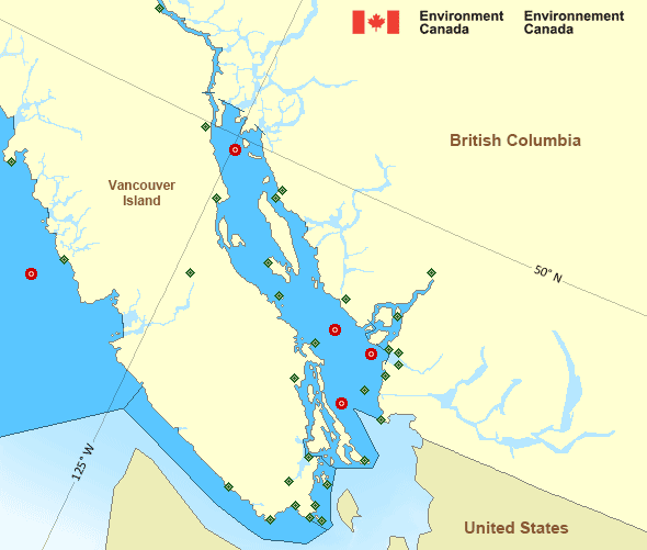
Strait of Georgia - north of Nanaimo
Forecast
Marine Forecast
Issued 09:30 PM PDT 01 June 2024
Tonight and Sunday.
Strong wind warning in effect.
Wind southeast 10 to 20 knots increasing to southeast 20 to 30 Sunday morning.
Rain Sunday.
Extended Forecast
Issued 04:00 PM PDT 01 June 2024
Monday
Wind south 10 to 20 knots.
Tuesday
Wind southeast 25 to 35 knots diminishing to
southeast 10 to 20.
Wednesday
Wind southwest 5 to 10 knots becoming
variable 5 to 15.
Stay connected
Weather Conditions
Zoom-in to make a selection

Legend:
Ice Conditions
There is no ice forecast issued for this area.
Warnings
Warnings (In effect)
Strong wind warning in effect
Strait of Georgia - north of Nanaimo
Issued 9:30 PM PDT 01 June 2024'Strong' winds of 20 to 33 knots are occurring or expected to occur in this marine area. Please refer to the latest marine forecasts for further details and continue to monitor the situation through Canadian Coast Guard radio or Weatheradio stations.
Synopsis
Technical Marine Synopsis
Issued 9:30 PM PDT 1 June 2024 Tonight and Sunday At 9:30 p.m. PDT tonight departing ridge located on a linenorth-south over Vancouver.
At 9:30 p.m. PDT tonight frontal system located over Bowie.
By 6:00 p.m. PDT Sunday departing frontal system located over the
Mainland Coast.
At 6:00 p.m. PDT Sunday low 990 mb located over southern Bowie.
Marine Weather Statement
Issued 9:15 PM PDT 1 June 2024 A Pacific frontal system over Bowie this evening will track slowlyacross the coast on Sunday. Southeast gales will occur ahead of the
front over central and northern waters and west of Vancouver Island.
Winds will likely reach storm force near the headlands of Northwest
Vancouver island near midday Sunday.
Pacific - Georgia Basin Area
Another Region
Features
New Predicting and Alerting Coastal Flooding Program

Find out about coastal flooding coverage, forecasts and warnings in your region
- Date modified:
 ATOM
ATOM