Language selection

Weather shortcuts

Juan de Fuca Strait - east entrance

Forecast

Marine Forecast

Issued 04:00 AM PST 06 December 2024

Today Tonight and Saturday.

Wind east 5 to 15 knots becoming light near noon then increasing to west 15 to 20 Saturday morning. Wind increasing to west 20 to 30 near noon Saturday.

Periods of rain tonight and Saturday morning. Showers Saturday evening with a risk of thunderstorms. Fog patches dissipating late this morning.

Extended Forecast

Issued 04:00 AM PST 06 December 2024
Sunday Wind west 20 to 30 knots diminishing to west 10 to 20 in the afternoon and to light late in the day.
Monday Wind light becoming east 5 to 15 knots.
Tuesday Wind east 5 to 15 knots.

Stay connected

ATOM

Weather Conditions

Skip Image

Zoom-in to make a selection

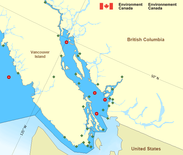
Map of Pacific - Georgia Basin marine weather areas Sentry Shoal - 46131 Halibut Bank - 46146 La Perouse Bank - 46206 Georgia Strait - 46303 English Bay – 46304 Discovery Island Esquimalt Harbour Kelp Reefs Malahat Race Rocks Lightstation Saturna Island Sheringham Point University of Victoria Victoria Gonzales Victoria Int'l Airport Ballenas Islands Campbell River Airport Comox Airport Entrance Island Fanny Island Nanaimo Airport Sisters Islets Estevan Point Port Alberni Tofino Airport Grief Point Howe Sound - Pam Rocks Powell River Airport Sechelt Squamish Airport Point Atkinson Sand Heads Lightstation Tsawwassen Ferry Terminal Vancouver Int'l Airport Vancouver Harbour West Vancouver
Legend:
buoy Buoy
land station Land Station
Ice Conditions

There is no ice forecast issued for this area.

Warnings

No watches or warnings in effect.

Synopsis

Technical Marine Synopsis

Issued 4:00 AM PST 6 December 2024 Today Tonight and Saturday At 4:00 a.m. PST today frontal system located on a line north-south
over the offshore waters.
By 9:30 p.m. PST tonight departing frontal system located from
the Central Coast to Tofino.

At 4:00 p.m. PST today frontal system located off Bowie.
By 4:00 a.m. PST Saturday departing frontal system located on a
line northwest-southeast over Haida Gwaii.

Marine Weather Statement

Issued 3:32 AM PST 6 December 2024 A frontal system over Haida Gwaii will track southwards across
Vancouver Island tonight. Ahead of the front, southerly gales will
continue today over central and southern waters, and then spread to
the inner South Coast this afternoon and gradually ease tonight.

Localized southeast storm force winds over Queen Charlotte Sound and
the headlands of West Vancouver Island North will ease this
afternoon.

Another frontal system will track across the offshore waters tonight
and onto the North Coast early Saturday morning. Ahead of the front,
strong to gale force southeasterlies will develop over Bowie this
evening and then spread to northern waters overnight. In its wake,
winds will shift to strong to gale force southwesterly over most
outer waters tonight through Saturday.

Late Saturday afternoon into the evening most outer waters will shift
to strong to gale force northwesterly ahead of an offshore ridge of
high pressure.

Pacific - Georgia Basin Area

Another Region

Date modified: