Language selection

Weather shortcuts

West Coast Vancouver Island North

Forecast

Marine Forecast

Issued 09:30 PM PDT 15 May 2026

Tonight and Saturday.

Waterspout watch in effect.

Wind northwest 15 knots increasing to northwest 15 to 20 near midnight except northwest 25 south of the Brooks Peninsula. Wind northwest 15 to 20 except northwest 25 south of the Brooks Peninsula Saturday.

Showers ending Saturday afternoon.

Waves

Issued 04:00 PM PDT 15 May 2026
Today Tonight and Saturday. Seas 2 to 3 metres.

Extended Forecast

Issued 04:00 PM PDT 15 May 2026
Sunday Wind northwest 15 to 25 knots.
Monday Wind southwesterly 10 to 20 knots veering to northwest 10 to 20 late in the day.
Tuesday Wind northwest 10 to 20 knots increasing to northwest 25 to 35.

Stay connected

ATOM

Weather Conditions

Skip Image

Zoom-in to make a selection

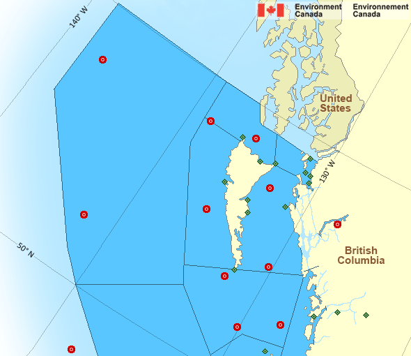
Map of Pacific - North Coast marine weather areas Masset Municipal Airport South Moresby - 46147 Bonilla Island Bella Coola Airport North Hecate Strait - 46183 Bella Bella Airport North Nomad - 46184 Sandspit Airport South Hecate Strait - 46185 Rose Spit Nanakwa Shoal - 46181 Langara Island Kindakun Rocks West Sea Otter - 46204 Cape St.James West Dixon Entrance - 46205 Sartine Island West Moresby - 46208 East Dellwood - 46207 Middle Nomad - 46004 South Nomad - 46036 Cathedral Point Prince Rupert Airport Lucy Islands Lightstation Holland Rock Dixon Entrance Central - 46145 Grey Islet Cumshewa Island
Legend:
buoy Buoy
land station Land Station
Ice Conditions

There is no ice forecast issued for this area.

Warnings

Watches (In effect)

Waterspout watch in effect

West Coast Vancouver Island North

Issued 4:21 PM PDT 15 May 2026 Conditions are favourable for the development of waterspouts.

Where: Strait of Georgia, Howe Sound, West Coast Vancouver Island

When: Now through Saturday morning.

Additional Information:
An upper trough is over the south coast of B.C. tonight, bringing a cool and unstable airmass. This airmass gives conditions favourable for waterspouts to develop.

Mariners are urged to take all necessary precautions and prepare for the possibility of waterspout activity. Postpone voyage or seek safe harbour if possible. Keep in mind that waterspouts cannot be seen at night and may strike suddenly.

Please continue to monitor alerts and forecasts issued by Environment Canada. For more information monitor Canadian Coast Guard radio or Weatheradio stations.

Synopsis

Technical Marine Synopsis

Issued 9:30 PM PDT 15 May 2026 Tonight and Saturday At 9:30 p.m. PDT tonight trough located on a line north-south over
Vancouver Island.
By 11:00 a.m. PDT Saturday departing trough located over Washington
State.

At 9:30 p.m. PDT tonight ridge located west of the offshore waters.
By midnight PDT Saturday ridge located over the Alaska panhandle
to Explorer.

At 9:30 p.m. PDT Saturday approaching frontal system located west
of Bowie.

Marine Weather Statement

Issued 9:13 PM PDT 15 May 2026 A trough over the southern waters will continue to generate
northwesterly gale force winds over Explorer this evening. Winds will
ease overnight as the trough moves southward.

In addition, the trough will create conditions favourable for
waterspout development over the Strait of Georgia, Howe Sound, and
west coast Vancouver Island from now through Saturday midday.

A ridge of high pressure will build over the offshore waters
Saturday. As the ridge approaches the coast, gale force westerlies
will develop through Juan de Fuca Strait Saturday afternoon before
easing to strong westerlies overnight Saturday.

Pacific - North Coast Area

Another Region

Features

Colour-coded weather alerts

Learn more about weather alerting in Canada

Date modified: