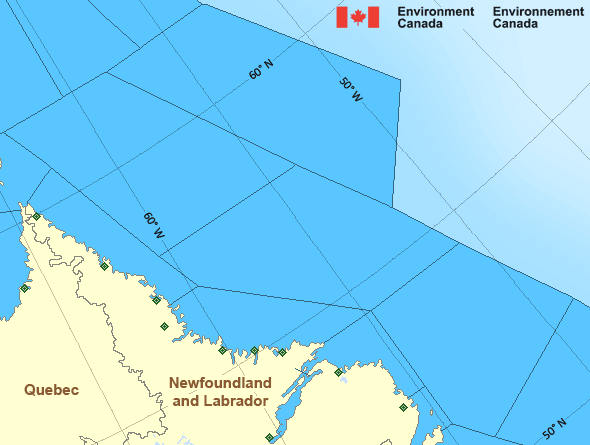
Mid Labrador Coast - north of Hopedale
Forecast
Marine Forecast
Issued 04:00 AM NDT 19 April 2024
Today Tonight and Saturday.
Wind northwest 15 knots diminishing to light this morning then increasing to southeast 10 to 15 this afternoon. Wind increasing to southeast 20 this evening and to south 30 late overnight. Wind south 30 Saturday.
Showers Saturday evening.
Temperatures minus 4 to zero rising to plus 2 Saturday morning.
Waves
Issued 06:00 AM NDT 19 April 2024
Today Tonight and Saturday.
Outside the ice edge seas 1 to 2 metres.
Extended Forecast
Issued 04:00 AM NDT 19 April 2024
Sunday
Wind southwest 25 knots diminishing to variable
10 to 15 late in the day.
Monday
Wind variable 15 to 20 knots.
Tuesday
Wind variable 15 to 20 knots.
Ice Forecast
Issued 10:00 AM EDT 18 April 2024 Today Tonight and Friday 2 tenths first-year ice including a trace of old ice except 9 plus
tenths first-year ice including a trace of old ice in the western
section. Consolidated first-year ice along the coast.
Stay connected
Weather Conditions
Zoom-in to make a selection

Legend:
Ice Conditions
Ice Forecasts
Issued 10:00 AM EDT 18 April 2024 Today Tonight and FridayIce Edge
First ice edge estimated from Newfoundland near 4934N 5429W to 5238N5222W to 5515N 5156W to 5641N 5703W to 6018N 6010W to 6200N 5854W
then northeastward. Sea ice west of the ice edge.
Second ice edge estimated from 6200N 5528W to 6121N 5510W to 6048N
5347W to 6051N 5135W then eastward. Sea ice east of the ice edge.
Ice Coverage
2 tenths first-year ice including a trace of old ice except 9 plus
tenths first-year ice including a trace of old ice in the western
section. Consolidated first-year ice along the coast.
Iceberg Bulletin
Issued 4:21 PM EDT 18 April 2024Iceberg Limit
Iceberg limit at 0000 UTC 19 Apr estimated from Newfoundland near4729N 5245W to 4805N 4945W to 5155N 4710W to 5445N 4940W to 5625N
4830W to 5800N 4525W then eastward.
Western iceberg limit at 0000 UTC 19 Apr estimated from Quebec near
5013N 6130W to Newfoundland near 4910N 5827W.
Iceberg Count
Unknown number of icebergs.Warnings
No watches or warnings in effect.
Synopsis
Technical Marine Synopsis
Issued 4:00 AM NDT 19 April 2024 Today Tonight and Saturday At 4:00 a.m. NDT today low 1005 mb located northeast of LabradorSea.
By 9:30 a.m. NDT today dissipating low 1005 mb located northeast
of Labrador Sea.
At 4:00 a.m. NDT today ridge located over western Labrador.
By 4:00 a.m. NDT Saturday ridge located over the East Labrador Sea.
At 9:30 a.m. NDT Saturday low 986 mb located near Ungava Bay.
Marine Weather Statement
Issued 3:50 AM NDT 19 April 2024 An intensifying low pressure system will approach the Hudson Straiton Saturday. Gale force southerly winds will develop over the
Labrador Sea Saturday afternoon ahead of this system.
Marine interests are advised that gale warnings are in effect for the
Labrador Sea.
Marine interests are also advised that a freezing spray warning is in
effect for Northwest Labrador Sea.
Atlantic - Labrador Area
- Belle Isle Bank
- Central Brevoort - northern half
- Central Brevoort - southern half
- East Brevoort - southern half
- East Labrador Sea
- Funk Island Bank - northwestern half
- Funk Island Bank - southeastern half
- Lake Melville
- Mid Labrador Coast - Hopedale and south
- Mid Labrador Coast - north of Hopedale
- Northeast Coast
Another Region
- Date modified:
 ATOM
ATOM